The Western Forests That Fill the Reservoirs Are the Ones Now Burning

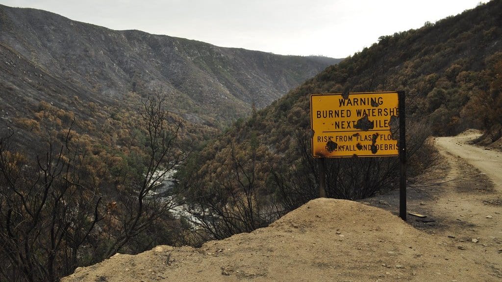
Trace the water in a Denver or Sacramento tap back far enough and the pipe becomes a mountainside: a patch of conifer forest holding snow through the spring and letting it go into a creek. Most of the West's water infrastructure is not built of concrete. It is built of forest, and the forest is burning.
Dalston J. Karto and Alicia M. Kinoshita of San Diego State University, with colleagues at NASA's Jet Propulsion Laboratory and the U.S. Geological Survey, analyzed the wildfire histories of 3,100 water supply watersheds reaching back to 1940. In Communications Earth & Environment, they report a significant regime shift in the late twentieth century. After the changepoints they detect, burned area doubles. A changepoint marks where a record stops behaving one way and starts behaving another.
That doubling is a before-and-after comparison rather than a fitted trend: these watersheds burn about twice as much after the shift as they did before it. The trend result is a separate finding, and it is the one that points most directly at water. Watersheds with a higher runoff ratio turn a larger share of the precipitation falling on them into streamflow, which is what makes a catchment worth building a reservoir below. In this record, those are also the watersheds with significantly increasing burn area trends.
Widening the analysis to 17,000 watersheds turns up something the totals hide. The fire regime is not simply intensifying; it is diverging. Watersheds are moving away from moderate burns, which cover 1% to 20% of a catchment's area, toward two poles: minimal events under 1% and extensive ones over 20%. Those figures describe how much of a watershed burned, not how large the fire was. A modest fire in a small headwater catchment can put it well into the extensive class.
This upper class is not an arbitrary cutoff. A study led by A. Park Williams found that western basins crossing it saw streamflow run about 30% above expectation for six years afterward. More water sounds like good news for a reservoir, but it arrives differently: faster, and carrying ash, sediment and burned soil, because a slope stripped of canopy and litter sheds rain instead of soaking it up. An ordinary storm over a burn scar can do what a much larger storm would not.
The vulnerability the paper maps is greatest in forested, mountainous country, and specifically in the catchments supplying 100,000 or more people downstream. For a water utility, the consequences show up as debris flows on steep ground, sediment filling a reservoir, and water that costs more to treat. That is why the paper's recommendation is as much about governance as hydrology: the authors argue for an integrated approach that treats land management and downstream water operations as one system, one that "may help secure water supplies and mitigate the cascading hazards from wildfire."
A fire record this long has a seam in it. Systematic satellite mapping of burn scars across the United States began in 1984, and the documentation for the long-run national fire datasets notes that records from before then are less likely to be complete, especially for smaller fires. A changepoint placed in the late twentieth century sits close to that seam.
The increase itself is not in question. Westerling and colleagues, working from a database of large western forest fires compiled since 1970, found large-fire activity rising "suddenly and markedly in the mid-1980s." Abatzoglou and Williams later estimated that human-caused climate change had doubled the cumulative area of western US forest burned since satellite mapping began. Neither reaches back to 1940, though, so both establish that the change happened without settling where in an 85-year record its turning point belongs. One detail in this paper's own numbers pushes the other way: better detection can only move watersheds out of the barely-burned class, never into it, and the regime is drifting toward that class as well as toward the extensive one.
Sources
- Communications Earth & EnvironmentPeer-reviewed
- Communications Earth & EnvironmentPeer-reviewed
- www.pnas.org
- www.pnas.org