Below a Burn Scar, an Ordinary Monsoon Storm Flooded the Grand Canyon

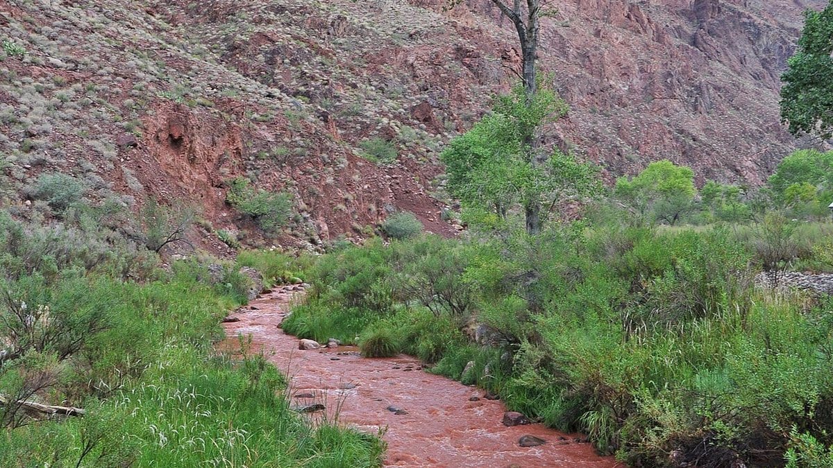
The flash-flood warning the National Weather Service office in Flagstaff sent at 2:42 p.m. on August 29 was not drawn around a county. It was written for "The Bright Angel Creek Basin below the Dragon Bravo Fire scar," the catchment below ground that burned last summer. Doppler radar had measured between a quarter and half an inch of rain over that basin, with as much again possible. The water was already moving.
That rain total is the part to sit with. That much rain on an August afternoon is an ordinary monsoon storm on the Kaibab Plateau, the kind that soaks in and is gone by evening. Below a burn scar it does not behave that way.
Fire changes what rain does long before the rain arrives. The needles, leaf litter and duff that used to catch a storm and hand it slowly to the soil are gone. Heat also drives waxy compounds out of the burning litter and into the top of the soil, where they cool into a water-repellent layer, so rain that would have sunk in runs off instead. The assessment team found that in the moderately burned ground: thin ash layers, some water repellency, root systems still intact. Steep, narrow drainages do the rest. They gather runoff from a wide area into a single channel and give it nowhere to spread, and what comes down is not clean water but a slurry of ash, grit, cobbles and burned wood that hits with far more force than water alone.
The Dragon Bravo Fire did not leave a moonscape. It ignited on July 4, 2025, on the Kaibab Plateau and burned for weeks, taking the Grand Canyon Lodge with it. It also burned in a mosaic: the assessment put 68 percent of the burned park land at low soil-burn severity and only about 1 to 2 percent at high. That is the pattern that normally means a landscape will repair itself, and in most respects this one is. Roots held. Seed sources stood. Plants were already resprouting when the team walked the ground. The flood came off that landscape anyway.
The team was a Department of the Interior Burned Area Emergency Response unit, the kind sent in after a large fire to work out what the next storms will move. It was in the field from August 19 to 26, 2025, checking satellite burn-severity mapping against the ground. Its executive summary reports runoff increases of two to eight times upstream of Phantom Creek and names where debris flows would concentrate: "steep, confined drainages, like Dragon Creek and upper Bright Angel Creek." Upper Bright Angel Creek is the drainage that flooded.
That sentence carries a qualifier, and the qualifier is the part to read closely. Such flows were "not expected because of typical monsoon events,"a judgment about typical monsoon rainfall under normal storm conditions, not a forecast that the creek would stay in its bed. The same paragraph says short-term increases in runoff and debris flow are expected, and the assessment noted that infrastructure at the modeled locations had been built above the modeled floodplains. The recommendations say the same thing in the form of money: of 15 emergency stabilization treatments the team requested, one is an early warning system, one is storm patrol and one is protection for the park's drinking water system. The summary also warns that anyone on the trails below the burn will meet frequent instability, "especially hazardous rockfall for at least the first year." The hazard had been located. What stayed open was what would count as a typical storm.
No one has quantified how much of this flood belongs to the fire, and for a single afternoon's storm no one may. The narrower statement holds: two federal agencies put the hazard in this catchment before the water arrived, one a year ahead in a hydrologic model, the other in a warning issued while the rain was falling. The forecasters told campers and hikers to get away from creeks and move to higher ground immediately, and said severe debris flows were expected downstream of the North Rim into Bright Angel Creek and Crystal Creek.
As of the morning of August 30, the park service reported 62 people evacuated from Phantom Ranch and the lower North Kaibab Trail, with more evacuations scheduled that day, and said no injuries had been reported as of the latest available information. A second release the same day asked the public for help accounting for approximately 15 individuals who may be missing or unaccounted for (an agency figure from an incident still under way that will change). News agencies citing park officials have reported one death; the park service statements of August 30 said no injuries had been reported as of that morning. Nearly all the footbridges over Bright Angel Creek were destroyed, and the Colorado River was closed to boat traffic after metal and debris from the corridor washed into it.
More thunderstorms were possible in the days that followed, the park service said, with more flash flooding, debris flows and rockfall along with them. That is the ordinary shape of the first year after a fire like this one. The fire itself is a year in the past; the ground it left is still deciding what the next storm does.