Asia Is Losing Groundwater Faster Than Africa Is Gaining It, Satellite Data Show
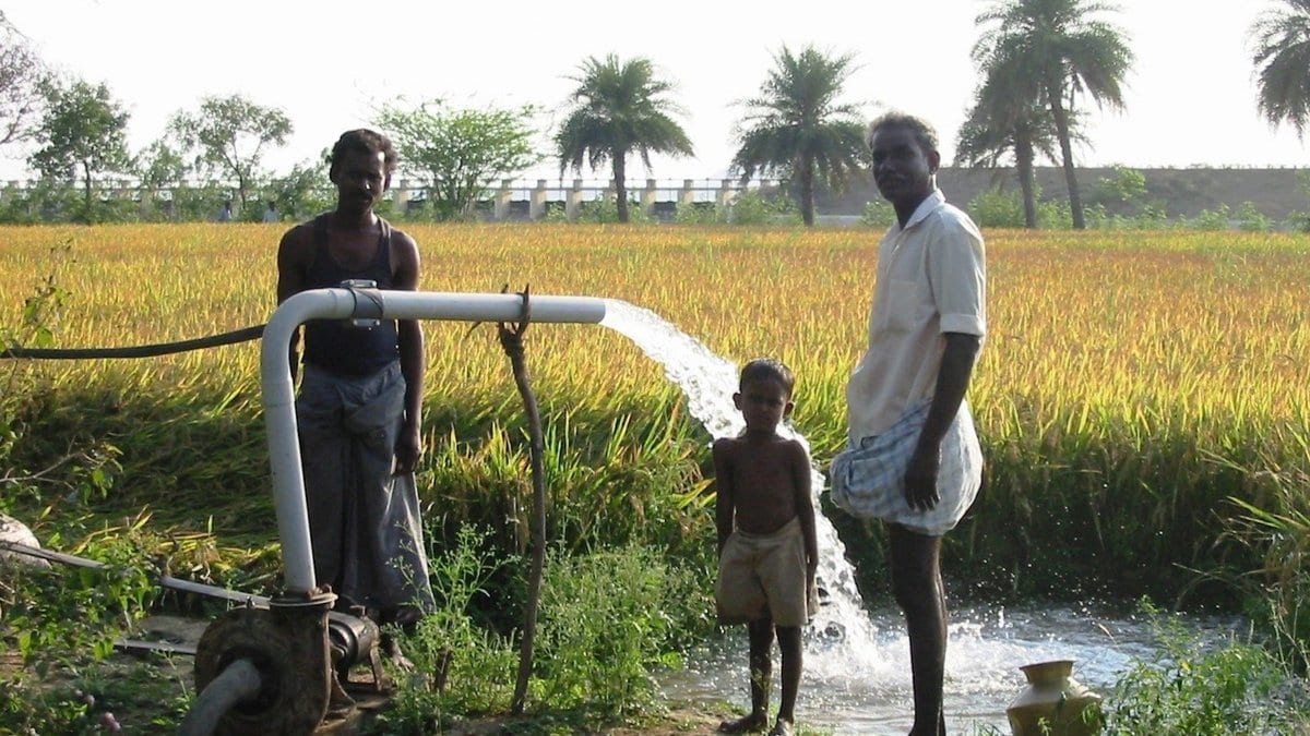
Asia's underground water stores are shrinking by about 55 cubic kilometers a year, while stores beneath large parts of Africa are growing by about 37. The figures come from 21.5 years of satellite gravity measurements, ending in September 2023, published Nov. 4, 2026, in Hydrology and Earth System Sciences.
Roland Hohensinn and Andreas Güntner of the GFZ Helmholtz Centre for Geosciences in Potsdam, Germany, and colleagues used the Global Gravity-based Groundwater Product, which subtracts soil moisture, snow, glacier mass and surface water from the total mass change the GRACE satellites record, leaving groundwater behind.
The authors of the study describe it as "the first globally consistent, publicly available groundwater dataset from satellite gravimetry for continental-scale water resources assessment." Because groundwater is what is left over, errors in the subtracted components carry into it, and the totals exclude part of the Canadian Arctic, where glacier signals bleed into the estimate.
The numbers are trends in water held underground, not in the amount pumped out. Globally, adding up only the places where the trend is statistically significant, the net groundwater change is a loss of about 27 cubic kilometers a year.
That net figure is the sum of much larger opposing changes. Gross losses run to about 103 cubic kilometers a year, roughly three-quarters of them offset by gains elsewhere, most of all in Africa.
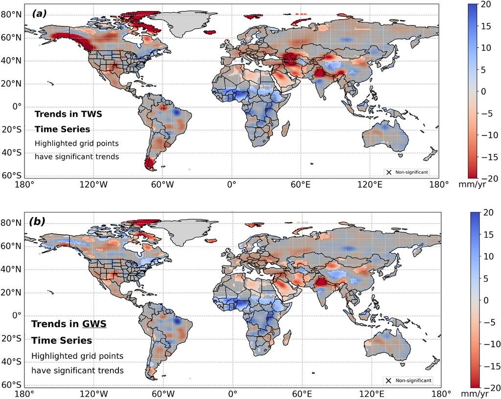
The sharpest losses sit in regions long known for heavy irrigation pumping: northern India, the North China Plain, Southwest and Central Asia, the Tarim Basin and northern Africa's fossil aquifers. The gains extend from the Sahel and the Niger Basin into parts of central and eastern Africa, and the data cannot pin them to a single refilling process.
Their gross loss figure is of the same order as earlier model-based estimates of global groundwater depletion. Glacier and ice loss, not groundwater, drives the steepest declines in total land water storage.
The dataset is public through GFZ Data Services and the GravIS portal, and the time series and trend estimates behind the paper are archived on Zenodo.
Sources
- Hydrology and Earth System SciencesPeer-reviewed