Three Philippine Typhoons, Re-Run in Three Atmospheres

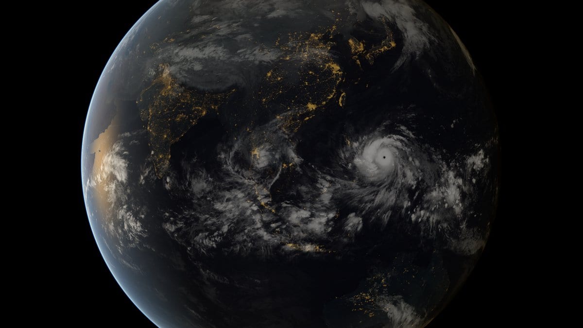
Haiyan is over. It came ashore in the Philippines in November 2013, and what it did there is a matter of record. But a storm that has finished happening can be made to happen again, which is the strange privilege of a regional climate model. Take the atmosphere the real Haiyan formed in, add or subtract a specified amount of warming, run the storm once more, and compare.
That is roughly what Rafaela Jane Delfino and Gerry Bagtasa of the Institute of Environmental Science and Meteorology at the University of the Philippines Diliman, with Pier Luigi Vidale and Kevin Hodges of the University of Reading and the UK's National Centre for Atmospheric Science, have done to three storms at once. Haiyan in 2013, Bopha in 2012, and Mangkhut in 2018 were each re-simulated under three climates and at two model resolutions, and the question put to them was not how hard they blew but how hard they rained. The peer-reviewed version appeared on July 31 in Natural Hazards and Earth System Sciences, open access.
The finding is not news as of today. The same four authors posted it as an EGUsphere preprint on October 5, 2025, under a different title, and Copernicus runs its peer review in the open, so the referee reports, the authors' replies, and a round of major revisions have been readable for months. What changed on July 31 is that the reviewed version is now the version of record.
The technique is called pseudo-global warming, and its appeal is that it holds the storm fixed and changes only the world around it. Rather than waiting for a climate model to grow its own typhoon, you take a real one and adjust the initial and boundary conditions of the simulation by a climate-change increment drawn from a set of CMIP6 models. The output is not a forecast of a future storm. It is a controlled experiment: this storm, this track, this structure, in a different thermodynamic environment.
Three environments were used. A pre-industrial atmosphere, the present one, and one under SSP5-8.5, the highest-emissions pathway in the standard set, describing a world in which greenhouse-gas output keeps climbing through the century. Each was run in two model configurations: 5 kilometers with a cumulus scheme, meaning convection is represented by a formula rather than simulated, and 3 kilometers convection-permitting, where the model resolves individual convective cells directly. For rainfall, that distinction is not cosmetic. Most of what falls out of a typhoon's inner core comes from deep convection, so a parameterized scheme is making an assumption about the very thing being measured.
Between the pre-industrial and present-day runs, inner-core precipitation rises by roughly 6 to 8 percent. Under SSP5-8.5 the increases are larger, and the paper describes them as robust across the three storms, with the strongest amplification again in the inner core. The extremes move furthest: extreme rainfall increases disproportionately, locally exceeding 30-40 percent.
Here, "locally" refers to the most extreme rainfall rates within the simulated storms under the highest-emissions scenario. They do not represent a storm's total rainfall, an average across the Philippines, or the rainfall expected at a particular location. The authors interpret the pattern as a shift toward short-duration, high-intensity rainfall rather than a uniformly wetter storm.
The more explanatory result is the one that says why. The team splits the rainfall change into a thermodynamic part, driven by the moisture a warmer atmosphere can hold, and a dynamic part, driven by changes in the storms' own circulation. The thermodynamic contribution runs to about 20 to 30 percent. The dynamic contribution comes in at about minus 10 to minus 30 percent, and it partially offsets the first. Offsetting is not cancelling. The net rainfall response is still upward; a chunk of the moisture-driven gain simply gets eaten by circulation changes before it reaches the ground.
The thermodynamic contribution follows the basic physics of a warmer atmosphere. Air at a higher temperature holds more water vapor, by roughly 7 percent per degree of warming under the Clausius-Clapeyron relation, and the authors report their increases as consistent with that scaling, with small deviations they attribute to increased storm intensity and to atmospheric warming. The magnitudes also sit inside the established assessment literature. A WMO-convened review published in 2020 in the Bulletin of the American Meteorological Society put the median projected increase in tropical-cyclone rainfall rate at about 14 percent per 2 degrees Celsius of anthropogenic warming, close to the rate at which the atmosphere's water-vapor capacity itself grows.
This case-study, run twice over, covers three storms, not a broader climatology. The authors make the limitation part of their own conclusion: case-to-case dynamics modulate the rainfall response, and variations in a storm's intensity and structure influence how its precipitation scales with sea surface temperature. Nothing here licenses a single percentage for Philippine typhoon rainfall in general. The high-emissions scenario is a bounding case rather than an expectation, and the past-to-present comparison is the part of the study anchored in warming that has already happened.
The same group has been working this seam for years, and its earlier results concern a different variable. Their 2023 paper in Climate Dynamics applied the same pseudo-global-warming approach to the intensity of these storms rather than to their rain. Wind and rain need not respond to warming in the same way or by the same amount, and figures from the intensity work do not transfer to this one.
The practical edge of the rainfall result is in the shape of the rain rather than the total. A storm that delivers its water in shorter, harder bursts is a different problem for a hillside, a culvert, and a river gauge than one that delivers the same water evenly. It is also the kind of change that shows up at 3 kilometers and gets smoothed away in a coarser model. That is the case these simulations make, across all three storms.
Sources
- Natural Hazards and Earth System SciencesPeer-reviewed