What Steers a River of Air Toward Asia's Cities

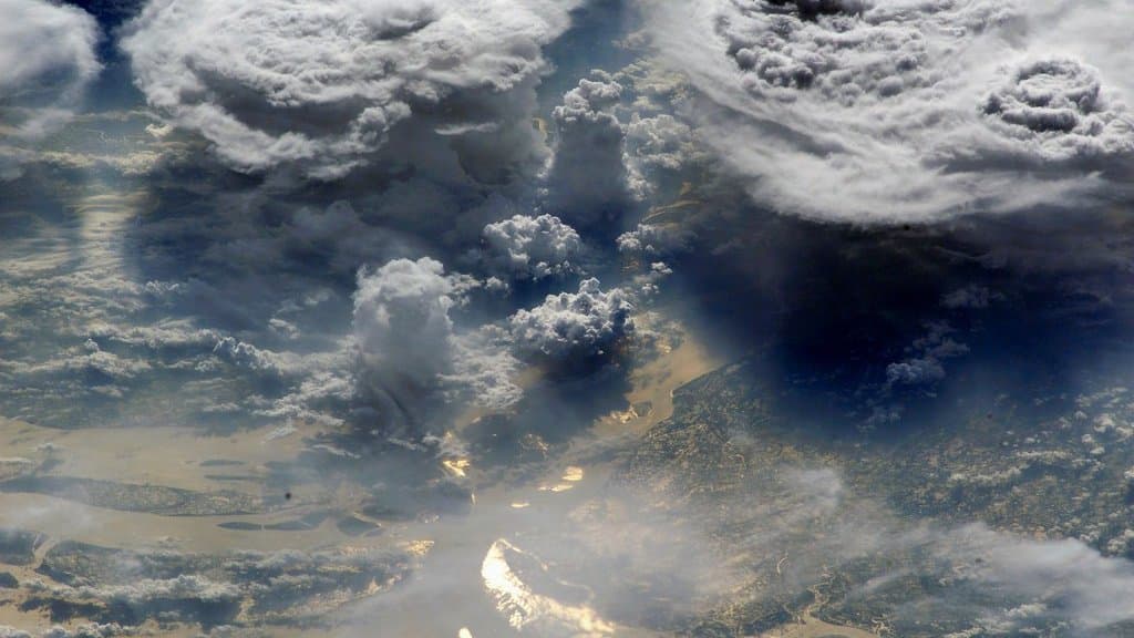
An atmospheric river is a corridor of water vapor sliding through the air toward a coast, and it behaves less like a storm than like plumbing. The water is going somewhere. What decides where it comes ashore is not the corridor so much as whatever stands in its path, and over the western Pacific what stands in the path is a dome of heavy, sinking air that summer puts there every year.
That dome is the hinge of a projection published Sept. 26, 2026 in Communications Earth & Environment. Ju Liang of China Agricultural University, Mat Collins of the University of Exeter and colleagues ran the future of Asia's atmospheric rivers through an ensemble of high-resolution climate models, and the result splits the continent by latitude. At lower latitudes, warming tends to hold atmospheric rivers back. Over the densely populated subtropical and midlatitude land, a wetter atmosphere strengthens them instead.
The two halves have different physics behind them. Warmer air holds more water vapor, which loads the corridors more heavily; that is the thermodynamic half, and it pushes only one way. The other half is circulation: the winds and pressure patterns that decide whether a corridor forms at all and which way it points. In the projection, circulation wins at lower latitudes and moisture wins over the subtropics and midlatitudes.
Neither half of that is new, and the paper says so in its second sentence: Asia's atmospheric rivers have already shown both effects as the climate changed. Two mechanisms pulling in opposite directions is the starting point rather than the finding. What the authors add is a projection of how the contest comes out over the coming decades, and an account of what does the sorting.
That account is a single sentence in the abstract, and it is the one that carries the rest. The pattern, the authors write, "relates to the anomalously steered moisture transport by the westward-extended subtropical high." In plainer words: the western edge of the Pacific dome acts like a wall that moist air has to travel around, so shifting the edge west shifts the moisture with it, onto some coasts and away from others. The paper says the latitude split relates to that steering. It does not say the steering causes it.
Getting that far required answering a question that sounds pedantic and is not: what is an atmospheric river? These features have no edges. A computer finds one only after someone has told it how much water vapor must be moving, in how narrow a band, over how long a distance, before what is on the screen counts as a river. Change those thresholds and the count changes, and potentially the trend in the count as well. So the study runs its projection under several different detection settings instead of one, and that is the part of the design that does most to make its answer worth having.
The authors describe their ensemble as the largest assembled from multiple high-resolution global climate models for projecting atmospheric rivers. That is their own evaluation of their own work.
What comes out are exposure numbers, and they are projections, not measurements. Population exposure to the extreme rain that atmospheric rivers bring is projected to rise across 58% of the world's atmospheric-river-active land, and urban regions within northern China, India and Bangladesh come out at +24–59%. Both figures need their scope kept on them. The 58% is a share of the map where these features occur, not a share of people and not a share of the planet. Exposure itself combines the rain with the people underneath it, so the +24–59% is neither a rainfall increase nor a national figure for the three countries named.
The direction has independent support. Kamae and colleagues, in Geophysical Research Letters in 2021, ran their own high-resolution global and regional simulations and found atmospheric-river moisture transport and rainfall both intensifying over East Asia in a warmer climate, concentrated on the southern and western slopes of its mountains. Different group, different models, same sign. The agreement is about direction; the exposure numbers are this paper's own.
The mechanism is where the honesty costs something. The steering sentence needs the Pacific subtropical high to reach farther west, and whether that high strengthens or weakens in a warmer climate has been contested at least since 2015, when Chao He and colleagues wrote in Scientific Reports that the outcome "remains inconclusive." Their own reading of a generation of climate models pointed the other way, showing the western North Pacific subtropical high weakening and retreating eastward in the middle troposphere, a few miles up. So the westward reach is an assumption inside this projection rather than a floor under it.
The paper is open access, and its acknowledgments thank three reviewers. Its title is hedged in the same way its mechanism sentence is: warming "is projected to divert" atmospheric rivers toward densely populated Asia. The text online now is the accepted manuscript, which the publisher says will be replaced automatically by the final edited version, so the wording can still move. The question underneath it will take longer. Until the models settle what the Pacific's summer dome of sinking air does in a warmer world, a projection of where Asia's heaviest rain goes next is, in part, a projection about that dome.