What Happens When an Antarctic Ice Model Believes the Radar

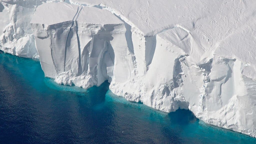
Somewhere under Antarctica there is a line where the ice stops resting on rock and begins to float. It is not a tidy line. Twice a day the tide lifts the ice a little and the sea works its way in behind it. Satellites carrying radar have been watching that boundary breathe, and what they find is not a line at all but a zone kilometers wide, with relatively warm, salty water reaching in under ice that every map calls grounded.
Ice sheet models were not built to let that happen. In a continental-scale model the grounding line is close to abrupt: it shuffles 100 to 200 meters over a tidal cycle, and melting from the ocean is switched off, or nearly off, behind it. Radar work at Thwaites Glacier by Rignot and colleagues put the intrusion at 6 to 12 kilometers, with melt rates in that zone reaching 50 meters of ice a year, far above anything the neighboring ice shelf sees.
That gap is what a paper published Sept. 21 in The Cryosphere sets out to close. Antonio Juarez-Martinez of Complutense University of Madrid and colleagues, working with Alexander Robinson of the Alfred Wegener Institute in Potsdam, who had the original idea for it, wrote a way to represent tidal intrusion inside a continental-scale model, bounded its strength against the radar maps, and ran the Antarctic Ice Sheet forward to the year 3000. Nothing in Antarctica was measured. What changes is what a projection is allowed to contain.
A kilometer-wide leak inside a 16-kilometer box
The awkwardness is arithmetic. The model divides Antarctica into square cells 16 kilometers on a side, and the process it needs to capture is a few kilometers long. There is no room inside a cell to draw it.
So the team stopped asking how far the water goes and asked how heavy the ice is. Height above flotation is the extra thickness, in meters, that keeps a column of ice on the bed rather than afloat. It is zero at the grounding line and climbs inland. Where it climbs steeply, the sea has nowhere to go; where the bed and the ice surface are nearly flat, the same small threshold in meters stretches out over kilometers of ground. The model therefore carries a single number, a threshold thickness, and lets ocean melting act on any ice thinner than it, tapering to nothing at the top of the range.
To find the right threshold, the team laid radar-mapped grounding zones from six Antarctic glaciers (Thwaites, Berry, Rennick, Moscow University, Totten and Amery) over contours of height above flotation drawn from the Bedmap3 bed map. The observed zones all fell below 250 meters, and typically between 15 and 130 meters. That range is a thickness of ice, not a distance inland; the intrusions themselves are kilometers long. The paper calls this calibration. One of the journal's three referees said on the record that comparison would be the better word, and the distinction is worth keeping: nothing here was fitted to a target. The journal publishes its reviews; a co-author sits on its editorial board, and an independent editor ran this one.
It does not work everywhere, and the authors name the place. At the Amery Ice Shelf the scheme fails to reproduce the observed grounding zone for every threshold they tried. Amery is also where the longest intrusion in the literature has been seen, up to 16 kilometers at spring tide. The authors blame the bed map, not the method: bedrock uncertainty under Amery runs past 250 meters.
A thousand years of letting the sea in
Then the runs. Two climate models supplied the forcing, CESM2-WACCM and CCSM4, each under a high-emission scenario: SSP5-8.5 and RCP8.5. Each drives the ice sheet to 2300; after that the forcing is frozen at its average for the 2290s and held there to the year 3000, leaving the ocean around Antarctica about 8 °C warmer in the first case and 6 °C in the second, indefinitely. These are sensitivity experiments under an extreme that never lets up, not forecasts of the year 3000.
Wider intrusion produced more melting at the grounding zone, and from there the chain the paper traces: faster ice streams, thinner shelves holding back less of the ice behind them, and a grounding zone walking inland. In the Yelmo ice sheet model under CESM2-WACCM, the projected Antarctic contribution to sea level by the year 3000 rose from 8.0 to 9.6 meters of sea-level equivalent as the threshold widened from zero to its largest tested value. Under CCSM4 it rose from 2.6 to 4.5 meters.
This century the difference is small, and the authors say so. By 2100 the whole spread is about 5 to 10 centimeters under the first forcing and 1 to 4 centimeters under the second. An appendix restates those same few centimeters as percentages, which look enormous and are ratios of numbers rounded to two decimal places.
Under the stronger forcing, West Antarctica collapses by the year 3000 whatever the threshold, so the entire spread at that date comes from East Antarctica. What tidal intrusion changes in the west is the clock: at the widest setting Thwaites Glacier goes nearly 100 years earlier than at zero.
The direction is not this group's alone. Robel and colleagues, using a different ice sheet model, reported in 2022 that a few hundred meters of intrusion-driven melt raises projected marine ice loss by 10 to 50%, and that kilometers of it can more than double that loss. The new result sits inside that envelope rather than past it. It is not the first look at grounding-zone sensitivity either, and the paper says so, naming earlier work.
What the scheme still cannot see
The missing pieces are the authors' own list. The scheme represents the reach of a tidal intrusion, not the tide: the hours-long cycle that drives it is never resolved. The threshold is the same everywhere in Antarctica. There is no subglacial water system in the model, so the salty wedge that theory says drives intrusion is absent. The ocean forcing is offline, so thinning ice never feeds back on the water below. Resolution matters most. The relationship held at 8 and 32 kilometers as well as 16, but the size of the effect moved with it, and the authors note that even 8 kilometers may be too coarse for the shorter intrusions, which would make these numbers an underestimate rather than an inflation.
What the work hands other modelers is cheap. The scheme adds no computing cost and asks only for bed elevation, ice thickness and sea level, which such models already carry; the code and the simulation output are both posted publicly. That may matter more than the thousand-year numbers, which rest on an emissions path nobody wants. The model is not trying to reproduce the ice loss satellites have measured over the past two decades, and the authors say it is unclear whether it could. Their argument is narrower and harder to dismiss: the place where ice stops resting on rock is not a line, and a projection that treats it as one is leaving something out.
Sources
- The CryospherePeer-reviewed
- doi.org
- doi.org