Satellite Surveys of Polar Ice Have Been Merged Into One Half-Century Record

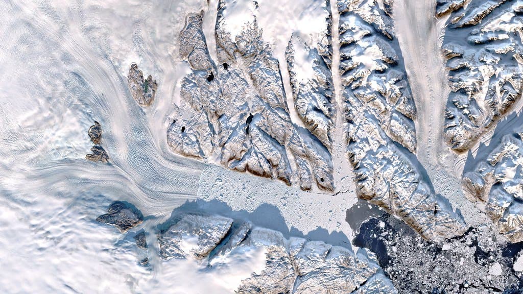
How much ice Greenland and Antarctica have lost is not one measurement. It is dozens. One group weighs the ice from orbit, with satellites that sense small changes in the pull of Earth's gravity. Another measures the height of the ice surface year after year and watches it drop. A third counts the ice flowing out to sea and subtracts the snow that falls inland. The three methods cover different years, carry different corrections, and do not always agree.
On Sept. 16, 2026, the international collaboration behind the Ice Sheet Mass Balance Inter-comparison Exercise, or IMBIE, published a record that puts 42 of those separate estimates onto a single timeline. The work appeared as a peer-reviewed data paper in Scientific Data and was led by Inès Otosaka and Andrew Shepherd of the Centre for Polar Observation and Modelling at Northumbria University, in the UK. It draws on measurements from 27 satellite missions. The point of the exercise is practical: the ice sheets are the largest single source of uncertainty in forecasts of future sea level, and a forecast can only be tested against a record long enough to argue with.
The reach back is the part that took work. The previous IMBIE assessment started in 1992. This one starts in 1972 for Greenland and 1979 for Antarctica, because the team went into the Landsat picture archive, which reaches that far, and used those early images to measure how fast the outlet glaciers were moving in years no ice survey had covered. The early coverage is thin. Where a year had no usable speed measurement, the team filled the gap by interpolating between the ones it had, and widened the stated uncertainty in proportion to how far away the nearest real measurement was. "By reaching back to the 1970s, we can now see how the ice sheets have changed across half a century," Otosaka said in a release from the European Space Agency, which supports IMBIE together with NASA.
Between 1979 and 2023, the two ice sheets together lost 11,309 billion metric tons of ice, give or take 565 billion. That is enough to raise the global sea by 3.14 centimeters, a little over an inch. The same mass in US short tons comes to about 12.5 trillion, the form the figure has taken in some American reports. It is one measurement in two units, not two measurements.
The record also splits the loss by process. Ice flowing off the sheets into the sea, faster than snowfall replaced it, accounts for 84% of the total; melting at the surface accounts for the rest. That is an accounting of how the ice left, not of what pushed it out, and it does not read the same at both poles. All of Antarctica's loss sits on the flow side of the line. Greenland's is about two thirds flow and one third surface melt, and in the 2010s, a decade of repeated extreme summer melting, Greenland lost more ice from its surface than from flow for the first time.
What is driving the flow is a separate question, and this dataset does not answer it. It counts only the ice whose loss adds water to the ocean, so the thinning and the retreat of the floating ice shelves, where the ocean meets the ice, sit outside it. Otosaka offered her own reading in ESA's release, saying the long-term trend "is being driven by the dynamic response of the ice sheets to a warming ocean." That is her interpretation of the pattern, not a result the record establishes.
Reconciling the estimates also makes the disagreements legible. Over East Antarctica the three methods differ not only in size but in sign, one showing ice being gained where another shows it lost. Only one of the Antarctic estimates comes from the method that counts ice out and snow in, which gives that single estimate unusual weight in the combined answer, and the authors write that it may lead them to underestimate East Antarctic gains. Over the years the new record shares with the old one, it puts Antarctic losses about half as much again as the previous assessment did.
The last four years of the record run against their own trend. Record snowfall over East Antarctica offset much of the loss from West Antarctica, and a run of milder summers roughly halved the ice Greenland lost at its surface. ESA's release notes that scientists read these as short-term swings rather than a reversal.
The combined record is published as a dataset with its own DOI and the code that produced it is openly archived, so another group can rebuild the combination or drop its own estimate into it. What the whole thing is for was put plainly by the researcher who founded IMBIE. "Just over three centimetres of sea-level rise may sound small, but that puts another six to nine million people at risk of coastal flooding and erosion," Andrew Shepherd said. Half a century of measurement is now the yardstick the next half century of models has to match.
Sources
- nature.comPeer-reviewed
- doi.org
- esa.int