The Ground Under Antarctica's Ice Edge Is Still Poorly Mapped

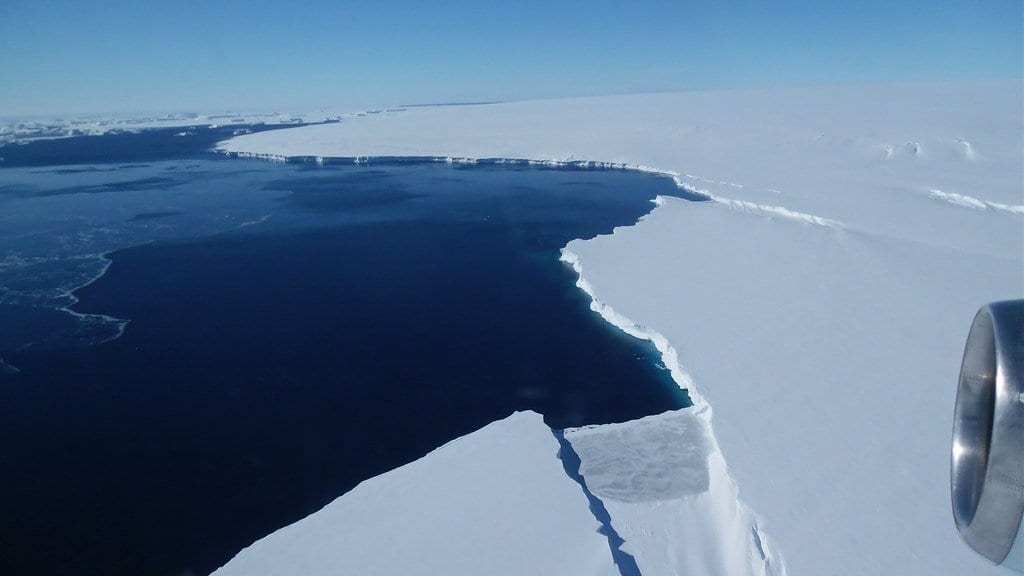
At the edge of Antarctica, the geography that matters is the part nobody can see. Somewhere beneath the ice, the sheet stops resting on rock and begins to float. The shape of the ground it crosses on the way out (every ridge, basin and channel) helps decide how fast the ice above can move and how much warm ocean water can get in behind it. A review published September 1 in Reviews of Geophysics, with 80 researchers from 16 countries behind it and Kenichi Matsuoka of the Norwegian Polar Institute as lead author, assesses what is known about that coastal zone. Its central finding is an absence: the bed beneath the ice shelves and the coastal ice sheet is still not well documented.
The coastal zone is where the ice sheet trades mass, heat and nutrients with the Southern Ocean, and the review describes it as holding multiple tipping mechanisms that could trigger large, rapid and potentially irreversible change over the coming centuries. Models of that exchange are acutely sensitive to what the ground is doing. The shape of the seafloor, and of the cavity between the underside of a floating shelf and the rock below it, governs how much ocean heat reaches the ice. Where those data are missing or only roughly known, the researchers warn, even an advanced model can return a misleading answer.
Satellites are little help with this particular problem. They track how fast the ice flows and how its surface rises and falls, continuously and in detail, but they cannot see the rock underneath it. Reading the bed means flying survey lines with ice-penetrating radar and gravity instruments, from aircraft working out of a handful of remote stations. "Satellite data alone are not enough to reliably estimate ice loss into the ocean, and computer models alone cannot predict future changes," Matsuoka said in the announcement from the Alfred Wegener Institute, one of the German partners; his remarks were: "Both depend on precise knowledge of the topography of the bed."
A companion analysis by Matsuoka and Calvin Shackleton, published in April in Philosophical Transactions of the Royal Society A, puts the geography of the gap on a map. They drew a 100-kilometer band around a simplified grounding line (taking in the fast-flowing ice, and the sectors where models project the grounding line will retreat by 2100) and asked, for every point inside it, how far away the nearest real measurement lies. More than 41 million radar-derived ice-thickness measurements from the Bedmap3 compilation went into the calculation. Coverage across the 27 drainage basins turned out to be wildly uneven. Thwaites and Pine Island glaciers, the two that dominate the worry, are well sampled. Enderby Land, Oates Land and the eastern Antarctic Peninsula have stretches where the nearest measurement sits 40 to 100 kilometers away.
That analysis also flags a category rather than a place: ice rises and rumples, the spots where a floating shelf runs aground on a high point of the seafloor and is slowed by it. They are broadly undersampled, which matters because those pinning points are part of what holds an ice shelf, and the ice behind it, in place.
What the review adds is a plan. Its authors ran an ensemble analysis of the published bed-topography datasets to identify significant data gaps and how they are distributed around the continent, then set out scientific priorities and guidelines for the aerogeophysical surveys that would fill them. The argument is for one comprehensive, coordinated international effort toward a next-generation dataset of Antarctic bed properties, rather than an accumulation of national ones.
No single country can survey a coastline that long. The work came out of the RINGS Action Group of the Scientific Committee on Antarctic Research, which coordinated the contributing glaciologists, oceanographers, geophysicists and atmospheric scientists, with logistical planning from COMNAP, the body that represents national Antarctic programs. "Uncoordinated surveys carry the risk that gaps are left or that work is duplicated," Matsuoka said. Some of that coordination is already scheduled: Graeme Eagles, an AWI geophysicist who has led RINGS survey flights, said Germany will gather new observations in the coming season working closely with the polar institutes of Norway and Japan.
The gap will not close from the air alone. Naomi Krauzig, a physical oceanographer at GEOMAR in Kiel and a co-author, points to autonomous platforms as the way to obtain badly needed data through the Antarctic winter and in places that are hard to reach beneath sea ice and, especially, beneath the ice shelves. Olaf Eisen, the glaciologist who represents Germany on RINGS, is plain about where things stand: the observations available now, he said, are still sparse, and they raise the uncertainties in both our grasp of the processes and our projections. The horizon Matsuoka names is the next International Polar Year, in 2032/33, for which a coordinated effort of this kind could serve as a springboard.
Sources
- Reviews of GeophysicsPeer-reviewed
- doi.org
- www.awi.de