An AI Model Sharpens Global Climate Projections Down to a City's Scale
A team at Google Research has published a generative AI system that converts coarse global climate model output into fine-scale weather without being shown matched coarse-and-fine examples of the same events. The system, called GenFocal, appeared Sept. 28 in Nature Machine Intelligence.
The paper frames the problem practically: global climate models run on grids too wide to tell a city or a grid operator what to prepare for, and the statistical methods used to add local detail miss the way heat, humidity and wind vary together.
Downscaling models of this kind normally train on paired data: a coarse simulation and a high-resolution record of the same hours. Those pairs do not exist for free-running climate projections, because a climate model's weather never lines up in time with the real thing. The authors say that requirement is what has kept machine learning out of this job. GenFocal is trained without it, on 20 years of a reconstructed global weather record, and evaluated on a later decade it had not seen.
What it produces is not a forecast. It generates large ensembles of fine-scale weather statistically consistent with the coarse projection fed to it, stepping grid boxes from about 1.5 degrees to 0.25 degrees. That describes the conditions a region could see, not what will happen there on a given day.
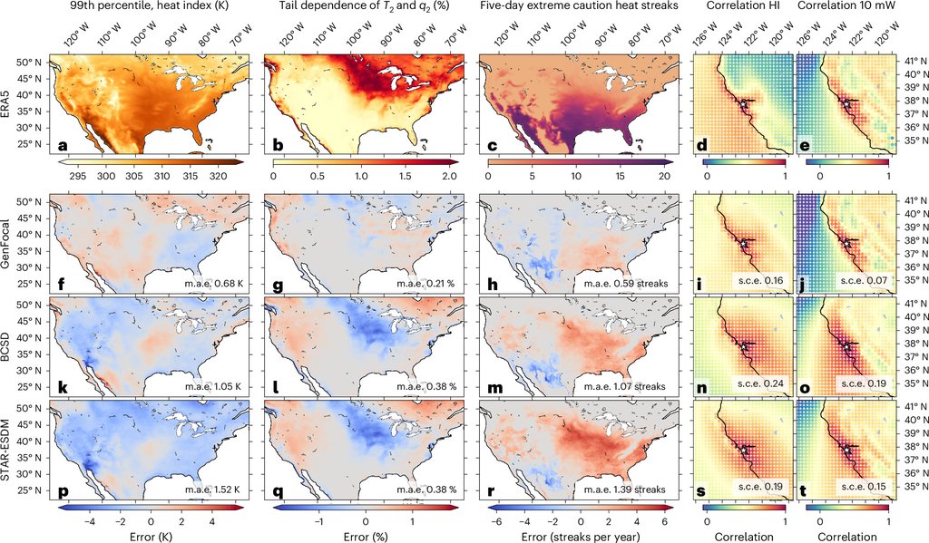
On the team's own evaluation against two statistical methods in wide use, BCSD and STAR-ESDM, GenFocal reduced average bias in the hottest summer heat-index values, a heat-and-humidity measure, across the continental United States by more than 35%, and in the frequency of five-day extreme-heat streaks by 44% and 57% against the two methods respectively. No independent evaluation of that comparison has been published.
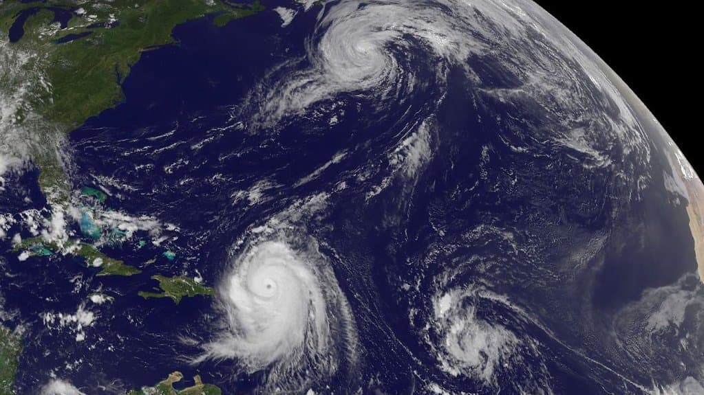
The authors also report that the model generates North Atlantic tropical cyclones, with formation points, tracks and intensities matching the historical record over the test decade, although the coarse input contains few such storms and cyclones were never a training target. Run forward, it projects more tropical storm and hurricane landfalls on the U.S. East Coast by the 2050s.
Sources
- Nature Machine IntelligencePeer-reviewed