A Volcanic Island That Collapsed in Stages: New Seafloor Imaging Rewrites Fogo's Ancient Megatsunami

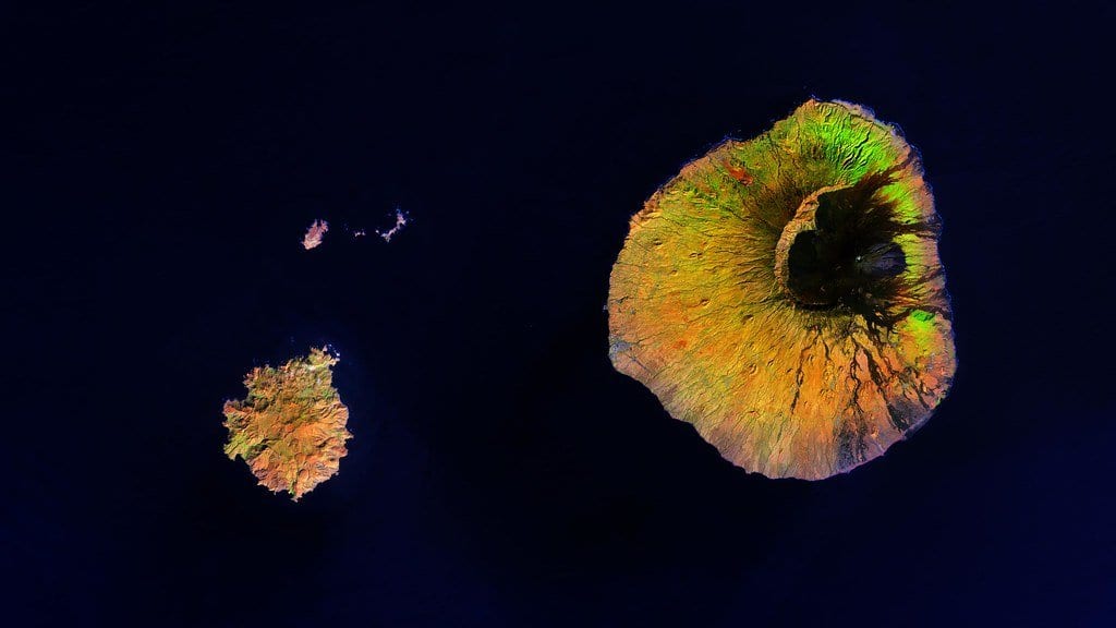
Somewhere off the coast of Fogo, in the dark under two kilometres of Atlantic water, lies the wreckage of a mountain. Tens of thousands of years ago a whole flank of the volcano let go and slid onto the seabed, leaving a scar you can still see from the summit ridge today, a vast horseshoe amphitheatre gouged out of the island's eastern side. Geologists have long suspected the failure was violent enough to throw a wall of water across the archipelago. What they could not do was see the debris itself in any detail. It sat too deep, spread too wide, and buried too much of its own story.
A team led by Emma Hadré, working with colleagues including Ricardo Ramalho and Sebastian Krastel, has now mapped that wreckage. Writing in the Bulletin of Volcanology on 11 July 2026, they report the first direct measurement of the Monte Amarelo collapse (the roughly 68,000-year-old event that tore the flank off Fogo), built from high-resolution multibeam bathymetry and multichannel seismic reflection surveys of the seafloor. The picture that emerges is both more precise and more surprising than the one it replaces.
Reading the seabed
The seafloor around an ocean-island volcano is not a blank plain. When a flank collapses, it does not vanish; it fragments into a chaotic apron of blocks and rubble that fans out for tens of kilometres, a submarine debris-avalanche deposit. From the surface it is invisible. But sound can reach it. Multibeam sonar rakes the seabed with fans of acoustic pulses to build a detailed relief map, while multichannel seismic reflection sends lower-frequency energy down into the sediment, returning echoes from the layers buried beneath. Together they let researchers trace not just the shape of the deposit but its internal structure and thickness. That is the difference between measuring a scar's outline and reading how deep it cuts.
Applied to Fogo, that combination let the team put hard numbers on a collapse that had only ever been estimated indirectly. They mapped a debris field covering 914 square kilometres (an area larger than the island of Fogo itself) and, by imaging the deposit's thickness rather than guessing at it, calculated a total collapse volume of about 98 cubic kilometres. It is the first volume figure for the event derived directly from imaging the submarine debris, rather than reconstructed from the size of the missing chunk of island.
A hidden second landslide
The bigger surprise lay in the layering. Sitting atop the northern half of the main deposit, the seismic images revealed a second, smaller mass. It was a debris body that earlier surveys had missed entirely. Its presence changes the story from a single catastrophic slump into something more staged: the flank appears to have failed in more than one episode, with a later slide riding over the older one.
That distinction is not a technicality. A volcanic flank the size of Fogo's holds an enormous store of gravitational energy, and how that energy is released governs the wave it makes. A single, instantaneous failure of the whole mass shoves the water column aside all at once and can raise a giant initial wave. A collapse that comes apart in stages (a large first failure, then one or more smaller ones) partitions that push into separate pulses, each generating its own, generally smaller, disturbance. The total volume can be similar while the tsunami it produces looks quite different in height, timing and reach.
Fogo's collapse is thought to have been genuinely tsunamigenic. Earlier work by Ramalho and colleagues, published in 2015, found boulders weighing up to hundreds of tonnes stranded high on the slopes of neighbouring Santiago island. Those rocks, the authors argued, could only have been carried there and lofted so far above sea level by a wave of extraordinary size. The new seafloor survey supplies the other half of that picture: the source deposit, measured and, for the first time, resolved into more than one moving mass.
A refinement, not a reversal
The updated figures nudge the event away from some earlier estimates. Previous reconstructions had put the displaced volume higher, in the range of roughly 110 to 130 cubic kilometres, and the timing nearer 73,000 years ago. The direct imaging trims the volume to about 98 cubic kilometres and places the collapse closer to 68,000 years ago. The event was still one of the largest known Atlantic ocean-island flank collapses; it now simply has sharper numbers attached, and a more complicated internal history.
Why a paleo-collapse matters now
None of this concerns a present-day threat at Fogo. The Monte Amarelo collapse happened tens of thousands of years before any written record. Its value is in what a well-characterised ancient failure teaches about the class of hazard it belongs to.
Steep-sided ocean-island volcanoes (the Canaries, Hawaii, Cabo Verde, Réunion) periodically shed their flanks into the sea, and the tsunamis such collapses can raise are among the hardest events to model, precisely because so much depends on details that are usually invisible: the volume that moved, how fast it moved, and whether it moved all at once or in pieces. Every collapse that can be measured directly, and resolved into its stages, tightens the assumptions that go into those models. Fogo, with its exceptionally well-preserved deposit and now its documented multi-stage structure, becomes a rare full-scale reference case: a natural experiment in how big volcanic islands come apart, and what the ocean does in response.
Sources
- Bulletin of VolcanologyPeer-reviewed