An Honest Map of Mars's Buried Ice, Including the Places Where the Answer Is 'We Don't Know'

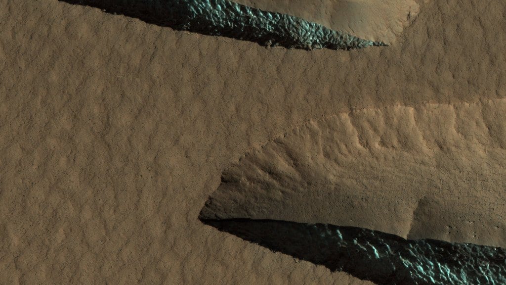
Every so often a meteorite punches through the dust of the Martian midlatitudes and leaves something startling behind: a splash of bright white ice at the bottom of a fresh crater, visible from orbit for a season or two before the thin air scrubs it away. Those craters, plus a handful of eroding scarps where a buried ice sheet stands exposed in cross-section, are the only places anyone has ever seen Mars's underground water directly. Everywhere else on the planet, the ice is an inference.
It is an inference worth a great deal. Ice a few meters down is the best surviving archive of how the Martian climate swung as the planet's axis wobbled, and it is the one heavy consumable a crew could not realistically bring from Earth. Yet the maps built to find it have long answered a softer question than the one anybody actually asks. They reported whether the available data were consistent with ice being present. They did not say how likely it was to be there.
A paper published online July 31 in The Planetary Science Journal sets out to fix that. Samuel Courville of the Planetary Science Institute and 11 co-authors, drawn from the U.S. Geological Survey, NASA's Goddard Space Flight Center, Purdue University, the Southwest Research Institute and the University of Arizona, recast the whole ice-hunting problem as a probability calculation. For every point in the Martian midlatitudes, the new map gives a likelihood that ice is present, an estimate of how much, and an honest error bar on both. The work is peer-reviewed: submitted in October 2025, accepted June 30 and published a month later.
Four kinds of evidence go into it, and none of them are new. Thermal spectrometers read the ground's response to the day-night temperature cycle, which is sensitive to ice within roughly the top tens of centimeters. Radar sounders probe far deeper, distinguishing icy material from rock by its dielectric behavior. A neutron spectrometer counts hydrogen in the upper half-meter or so. Geomorphology contributes too: scalloped depressions, debris-covered glaciers, pedestal craters and five other landform types each carry their own quiet testimony about what lies underneath.
Those datasets are the ones the Subsurface Water Ice Mapping project, or SWIM, has been assembling since 2019. No spacecraft went out and measured anything new for this study. What changed is the arithmetic. A Bayesian framework multiplies the probability distributions from each dataset together, so agreement between two instruments sharpens the estimate and disagreement widens it, and the width itself becomes a published number. Against the SWIM product line, that is the genuine first here: earlier versions carried qualitative consistency ratings, which by construction could not express abundance or doubt.
The good news arrives in the midlatitudes. Poleward of about 45 degrees in both hemispheres, near-surface ice, within the top 5 meters, is likely present. North of Alba Patera the maximum-likelihood ice content reaches 43.3% by volume; in Hellas Planitia it reaches 46.3%. Those figures deserve a scale to be read against. Martian regolith has a pore capacity around 40%, so ice at 43% or 46% is only modestly in excess of what could simply fill the gaps between grains. It is a real excess-ice signal, and a cautious one.
Closer to the equator, the map does something maps rarely do. It declines to answer. Across most regions equatorward of 40 degrees, the models with the highest likelihood sit at or near zero ice. The best estimate is nothing. But the uncertainty around that best estimate is wide, wide enough that, in the authors' words, the data are not sufficient to rule out moderate quantities of pore-filling ice even at equatorial regions.
That distinction is the whole point of the exercise, and it is easy to garble. Forty-five degrees is the line poleward of which ice becomes likely. Forty degrees is the line equatorward of which the best guess falls to zero. Neither is a line below which the instruments go blind, and a best guess of nothing is not the same thing as knowing there is nothing there. The old consistency ratings had no way to draw that difference; a probability with an error bar does.
There is a third kind of answer buried in the results, and it is the most awkward one. The blindness is not only lateral; it is vertical. Thermal and neutron sensing fade out within the first meter, and radar sounders come into their own well below that. In between sits a window where, as the paper puts it, existing orbital data are insufficient to constrain ice quantity and ice depth, especially for any ice that may exist at depths of about 1 to 10 meters. That is roughly the range a drill or a scoop on a crewed mission would be working in.
A companion paper in the same journal issue attacks that gap from the thermal side. Hanna Sizemore and eight colleagues, seven of them also authors on the Courville paper, compare global thermal ice maps and run one-dimensional thermal simulations, and find detection sensitivity falling off rapidly below about 30 centimeters. That fall-off, they write, produces maximum uncertainty in the presence and depth of ice within regions preferred for potential human landing sites.
Their recommendation is specific: a future mission aimed at crewed landing-site selection should give payload priority to an instrument capable of probing the 1 to 5 meter depth range, meaning a high-frequency radar, rather than to a next-generation thermal spectrometer. Both papers come out of the same SWIM consortium, so the second is best read as a consistency check from inside the project rather than as outside confirmation.
The exploration framing belongs to the scientists, not to anyone paraphrasing them. The first sentence of Courville's abstract calls subsurface ice "an important resource for potential future human exploration," and the introduction notes that at midlatitudes, where future missions will likely be constrained, knowing where the ice is could be crucial for crewed missions. What neither paper does is name, rank or recommend a single candidate landing site. Nothing here is a shortlist. The companion's claim is narrower and more uncomfortable than a shortlist would be: the band of latitudes most attractive to mission planners is also the band where the ice measurement is least trustworthy.
Courville's team frames the payoff plainly: their uncertainty estimates, they write, "allow future analysis and exploration to target regions of high uncertainty." Sizemore's team has already named the instrument that would do the targeting. Collectively, these two papers establish clear objectives for a future mission: the development of a dedicated instrument and a set of target coordinates where subsequent observations would yield definitive results.
Sources
- The Planetary Science JournalPeer-reviewed
- The Planetary Science JournalPeer-reviewed
- phys.org
- doi.org
- swim.psi.edu