Seawater Seeping Under Thwaites Glacier Doubles Its Projected Sea Level Rise
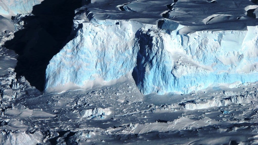
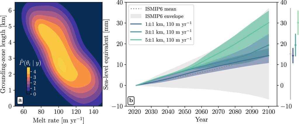
An ice sheet model reproduces nearly three decades of Thwaites Glacier's retreat only when seawater is allowed to seep 2 to 5 kilometers beneath ice still resting on the seafloor, according to a study published Oct. 12, 2026, in Nature Communications. Run forward with that mechanism in place, the same model projects up to 30 ± 6 mm of global sea level rise from Thwaites by 2100, which the authors put at approximately double previous projections, and it reaches that figure without adding any further ocean warming.
The West Antarctic glacier holds enough ice to raise the global ocean by 65 cm, and the paper calls it a major source of uncertainty for future sea level rise. Mattia Poinelli and Eric Larour of the Jet Propulsion Laboratory at Caltech and colleagues set out to narrow that uncertainty by requiring the model to match what satellites have already measured before letting it project anything.
Satellites recorded about 25 km of retreat along the glacier's fastest-flowing sector since 1996, and radar images from the ICEYE satellites have shown seawater pushing kilometers inland beneath the grounded ice and lifting it as the tide comes in. Most ice sheet models leave that out, treating the boundary between grounded and floating ice as a sharp line.
The authors report that models using the sharp line were four times less likely to reproduce the observed record than models given a grounding zone, a melting band a few kilometers wide. The width of that zone also decides when Thwaites slips off the seafloor ridge now steadying it: at the widest settings, which match the most recent satellite measurements, the glacier comes off the ridge as early as 2038 and keeps retreating toward the next rise in the bedrock.
The paper also reports that the projected contribution responds less to moderate ocean warming than to how wide that zone is.
Sources
- Nature CommunicationsPeer-reviewed