A Satellite Map of the World's Tea Farms Weighs Income Against Food and Nature
Researchers have mapped the world's tea plantations from satellite imagery and scored nine tea-growing countries on what the crop can earn, how its land sits beside food crops, and how it sits beside areas that matter for wildlife. The work was published Nov. 12, 2026, in Communications Earth & Environment.
The team, led from Fuzhou University in China, says the results support deciding where plantations should go, managing them better and building up the businesses between farm and cup, with the balance differing from country to country. The authors write that tea is an important source of income across Asia and Africa, and that the land it takes up may create trade-offs with food security and with the conservation of wildlife.
The dataset, which the group calls GlobalTea10m, comes from satellite observations processed with cloud computing and checked against ground-reference data its members collected. From it the researchers built a composite score in three parts: a potential economic benefit that combines yield and quality, a food-security score and an ecological-security score. Five of the nine countries scored relatively high on at least two of the three.
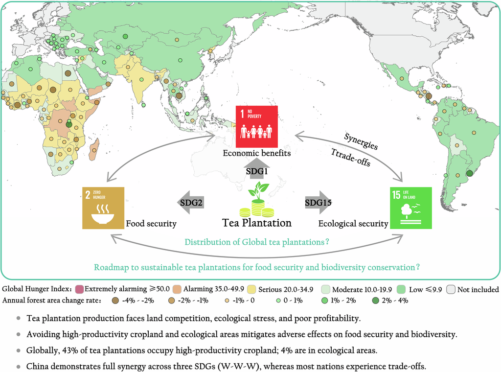
The authors report that China showed the strongest overall balance of the nine. India scored favorably on food and ecological security and more weakly on economic benefit, while Sri Lanka had the highest economic score with lower food and ecological scores. Rwanda and Tanzania came out unbalanced in opposite directions, and Kenya underperformed on every measure.
The paper maps plantations overlapping productive cropland and land flagged as a priority for conservation, and calls the overlaps a potential land-use trade-off that does not by itself show that food production has fallen or that ecosystems have been degraded.
The paper's first author is Yufeng Peng of Fuzhou University, and the corresponding authors are Bingwen Qiu there and Qiangyi Yu of the Key Laboratory of Agricultural Remote Sensing in Beijing. Co-authors are based in Kenya, Indonesia, Egypt, Serbia and Poland, and at the UN Food and Agriculture Organization. The National Natural Science Foundation of China paid for the work.
Sources
- Communications Earth & EnvironmentPeer-reviewed