At One Edge of a Canadian Arctic Glacier, Seawater Can Reach 2.4 Kilometers Farther Under the Ice

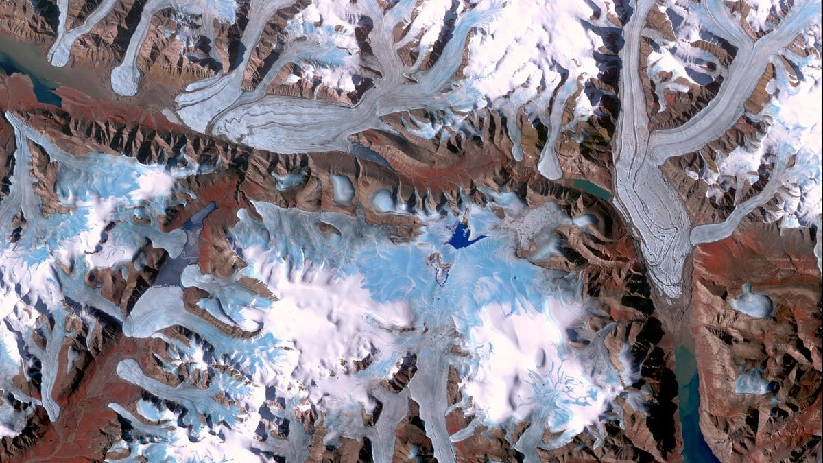
Under the eastern side of Milne Glacier, on the north coast of Ellesmere Island, the bedrock rises into a low ridge. For years, it did the work of a door sill: the glacier rested on it, seawater pushed at it twice a day with the tide and the water did not get past.
That edge of the glacier was the quiet one. Between 2011 and 2023, it gave ground to the sea at 29 meters a year, about a quarter of the rate at the western edge, according to the same team's earlier survey in Remote Sensing of Environment. Then, in October 2023, the radar images began to show a notch at the eastern margin, a bite taken out of the line where the ice stops resting on rock and starts to float.
That line is the grounding line, and nobody can see it directly. What a satellite can see is the strip of ice just seaward of it that bends up and down with the tide. Yulia K. Antropova and Derek Mueller, both at Carleton University in Ottawa, mapped that strip 116 times on Milne Glacier between February 2023 and September 2024. Their report, written with colleagues at Natural Resources Canada, Environment and Climate Change Canada, the University of British Columbia and Université Laval, appeared in The Cryosphere on Nov. 13, 2026.
The images come from the RADARSAT Constellation Mission, radar satellites run by the Canadian Space Agency that cross the same ground every four days. The method, double-difference radar interferometry, subtracts one pair of passes from another, which cancels the glacier's steady flow and leaves the motion of the tide. The flexing ice then shows up as a pattern of fringes, and its inland edge is what gets mapped.
The number the paper leads with is 2.4 kilometers, and the paper is careful about what it attaches to. At the easternmost margin, measured parallel to the eastern profile, the notch reached up to 2.4 kilometers farther inland than the grounding zone mapped before it. Along the eastern profile itself, the gap between the most landward positions seen with and without the notch is about 690 meters. The grounding line of Milne Glacier has not moved back that far. One corner of it has been seen that far in.
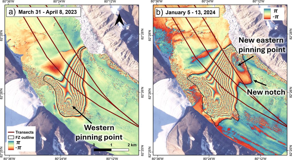
Nor is that corner's new position a fixed one. The notch is in some of the images from October 2023 onward and absent from others, and it appears when the sea stands high. On the passes that caught it, the highest water averaged 0.21 meters, against 0.13 meters on the passes that did not; the authors tested that difference and found it unlikely to be chance (p = 0.009). So the figure is the farthest that tidal seawater has been seen to reach behind the newly ungrounded ridge, not a line the glacier now holds. No uncertainty is published for the distance itself; the paper says only that it was detected in the low-error images.
Their account of how it happened runs through the shape of the bed. Melt over the summer of 2023 let the grounding line past the next rise inland, one of the bumps that a glacier sits on, which glaciologists call pinning points. Behind that rise, the bed slopes downward as it goes inland, so once seawater was over the sill, it had somewhere to go, and the cavity stayed open. The water moving in and out of it with the tide sits about 1 °C above the freezing point at depth, which is why a couple of kilometers of intrusion can matter to how fast a glacier melts from below. Farther up-glacier, a small rise is probably holding the water back now, and a larger one past that is the likely next stopping place.
The other half of the study is about how far any of this can be trusted. The method assumes the glacier's speed does not change between passes, and when it does, the fringes shift for reasons that have nothing to do with the tide. From the orbits that looked at the shallowest angles, during a winter stretch when the ice flowed steadily, the inland edge of the flexing strip could be placed to within about 8 meters, less than one pixel. From the orbit that looked at the steepest angle, while the glacier was slowing after its summer peak, the same calculation gave about 222 meters. Those are uncertainties on where a single map puts that edge, not error bars on the retreat.
That spread, a factor of nearly thirty on the same ice with the same instrument, is the part of the work that travels beyond Milne Glacier: a line that looks as though it has moved may only have been measured from a worse angle. The conclusions end on the other half of it. "Bed geometry, specifically pinning points, plays a crucial role in shaping the flexure zone and governing grounding-line retreat." A ridge under the ice can hold a line still for a decade and then let it go.
The work is peer reviewed and open access, and The Cryosphere publishes the referee exchange beside it. It covers one glacier over 19 months. The plain-language summary the authors wrote for the paper opens on climate: "Arctic glaciers that flow into the ocean are changing rapidly due to climate warming." What they attach to the retreat itself is narrower: melt in one summer, water standing high, and a ridge in the bed giving way.
Sources
- The CryospherePeer-reviewed