The Global Ocean's Warmest Day on Record Came in the Wrong Month

Take every stretch of open ocean outside the polar seas, average the surface temperature across all of it, and the number you get has a season of its own. It is not the season most people live in. It runs high in March and April, a couple of months after midsummer in the southern hemisphere, and by August it is normally well down from its high for the year.
On Aug. 22 it was not. The daily average came out at 21.1 °C, the warmest day in the record kept by the Copernicus Climate Change Service, which the European Centre for Medium-Range Weather Forecasts runs for the European Union. The value it passed, 21.09 °C, was set in March 2024, the month the ocean is supposed to be at its warmest. "The timing of the record is particularly notable," C3S wrote in its announcement. "Global ocean temperatures are typically highest in March and April, following the austral summer, yet this record has been reached in August."
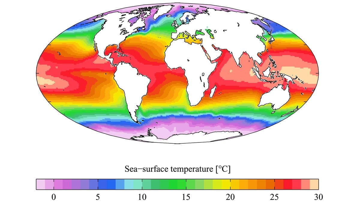
The ocean's calendar is a matter of geography before it is one of physics. The southern hemisphere is mostly water; the northern holds most of the land. A global ocean average is therefore weighted toward southern seas, and southern seas take their heat from a summer that peaks around the turn of the year. Water is slow about it: the sunlit layer at the top of the ocean goes on gaining heat for weeks after the sun has stopped climbing, which drags the warmest days out to March and April. Northern summer warms a smaller share of the same total area. The upshot is that the world's ocean, taken as a single number, keeps southern time.
That makes August against August the comparison worth having, and there the gap is not tight. The record beat the hottest August day previously logged, in 2023, by more than a tenth of a degree, a wide margin in a figure that averages half a planet. Against the all-time mark from March 2024 the margin is a single hundredth of a degree, narrower than the numbers are quoted to, and C3S says its scientists "continue to monitor the situation to determine whether the exceedance in daily SST is temporary or persistent."
It helps to know what the figure is a figure of. ERA5 is a reanalysis: one fixed weather model run over the whole observational record, absorbing observations from satellites, ships and buoys to produce a physically consistent estimate of conditions everywhere, including the stretches of sea nobody measured that day. Its sea surface temperature is an estimate for about 10 meters down, what oceanographers call the foundation temperature, and it can read differently from products that sample the top few centimeters. The series covers the ocean between 60 degrees south and 60 degrees north and begins in 1979, the point at which satellite coverage makes it reliable. Values can be revised. This is an operational bulletin, not a peer-reviewed paper.
As for what pushed this year off phase, Copernicus points at two things stacked on one another. One is a strong El Niño now developing in the tropical Pacific. The other is the ocean it is developing on, which has, in the service's words, "already been warming over many decades as a result of human-driven climate change." C3S seasonal forecasts suggest the event could reach levels not seen for several decades, and the World Meteorological Organization expects it to strengthen. NOAA's Climate Prediction Center, working from its own data, has an El Niño Advisory in force and puts the chance of a very strong event during the Northern Hemisphere fall and winter above 90 percent.
Still, the record says less about one day than about the level the whole cycle now rides on. The seasonal shape has not moved: March and April are still the ocean's warm months, and August is still past the peak. What has changed is the line underneath it. The year has brought a succession of monthly records and near-records across the same waters, July's among them, so by late August an off-peak ocean was warm enough to clear the old peak.
What a warmer surface does downstream is well established, and the release runs through it. The ocean expands as it warms, and sea level rises with it. It hands more heat and moisture to the air above, intensifying rainfall in some storm systems. It also takes up carbon dioxide less efficiently, weakening one of the buffers the rest of the climate leans on. Samantha Burgess, strategic lead for climate at ECMWF, put the ecological cost in one figure, saying the number of marine heatwave days globally "has more than tripled since the early 1990s."
The timing faces a natural next test. Both agencies expect El Niño to keep strengthening through the end of the year, which would leave it in the water when the ocean's own calendar comes back around to March and April, the months this average is built to peak in. Whether the warmth of late August is still there by then is what C3S says it is watching.