El Niño Forecasts Work Best When They Start During La Niña
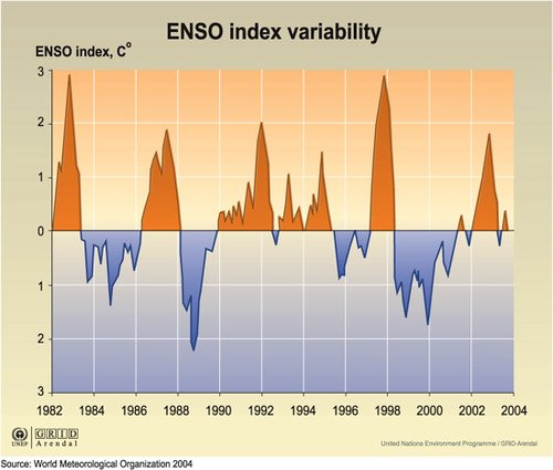
Whether a forecast of El Niño holds up a year ahead depends more on what the Pacific was doing when the forecast was made than on which model produced it, a team led by Australia's national science agency, CSIRO, reports. Forecasts started while La Niña conditions were in place caught the coming switch to El Niño a year in advance more than 70% of the time in three of the models examined.
The study, published Oct. 23, 2026, in Science Advances, sets the result out as a simple framework for deciding how much weight a long-range forecast deserves: someone planning around the El Niño and La Niña cycle can judge how likely a forecast issued today is to be right from the phase the Pacific is in now.
Predicting which way the cycle will turn beyond nine months has remained difficult. The researchers analyzed switches between phases in a set of hindcasts, forecasts re-run over past years so that their accuracy can be scored. The 70% is a hit rate over those past cases, counted only for forecasts that started from La Niña conditions, and the paper makes no forecast for the coming year.
Nandini Ramesh, of CSIRO's Natural Systems Modelling Group and the University of New South Wales, is the first author, and James S. Risbey of CSIRO is the senior author, with seven colleagues at CSIRO, the University of Melbourne and the Australian National University. CSIRO funded the work.
The authors describe the cycle as the main source of climate predictability beyond a single season across much of the world. They say their findings, if applied effectively, could improve strategies for forecasting it far in advance and help manage risk globally.
Sources
- Science AdvancesPeer-reviewed