What Seismometers Recorded as a Himalayan Mountainside Gave Way

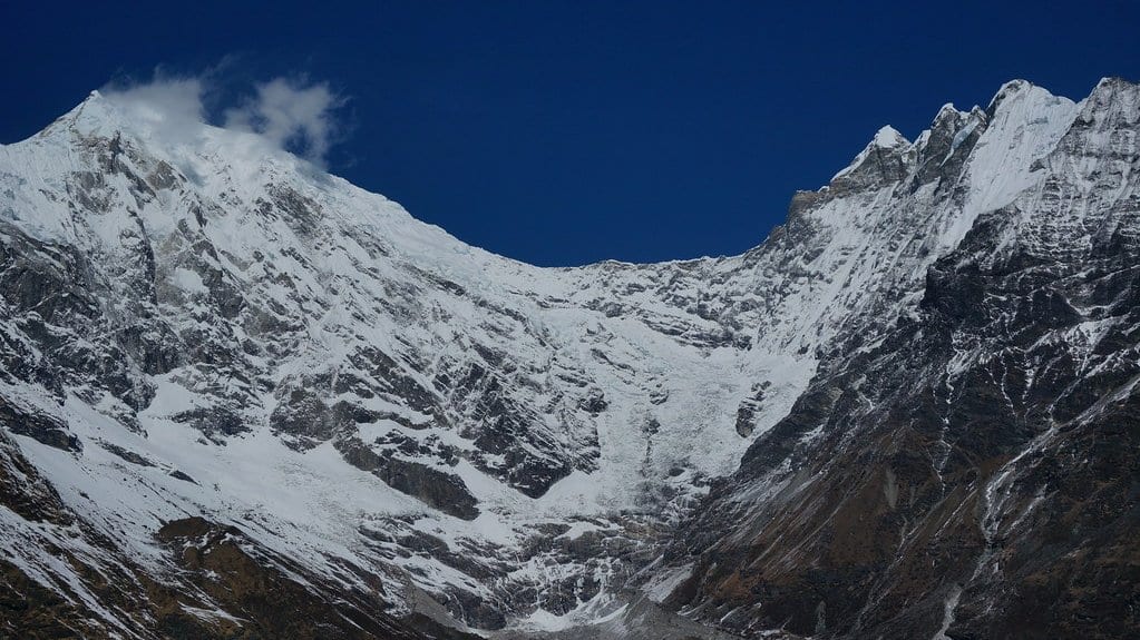
The videos were online within hours, and for several days nobody could say which mountain they showed. The University of Lausanne, one of the institutions behind the study, describes several days of work narrowing it down to a single slope: the north face of Tsangbu Ri, in the Langtang range on the border between Nepal and China. The instruments had been less confused. Seismometers across Nepal and China had written down the whole morning of Aug. 26, 2026, in ground motion, and a team of Nepali scientists and their international colleagues published what those records say on Oct. 2, 2026.
The study, led by Lok Bijaya Adhikari of the National Earthquake Monitoring and Research Centre in Kathmandu, appeared in Seismica as a Fast Report, the journal's short peer-reviewed format for getting an observation into the literature quickly. Its claim is a narrow one: this is the first complete set of seismic observations of the event from Nepal and China. Reading the first arrivals of high-frequency waves, the sharp onset that reaches a station first, the team locates the main mass movement and locates a smaller magnitude 2.5 event nearby, shortly before it. The flood that followed raised background noise for hours. Seismometers around the world picked the collapse up.
The sharper numbers that have traveled with the work come from the authors' own institutions. Lausanne, where the co-author György Hetényi is professor of geophysics, puts the main collapse at 02:52:16 UTC and the energy it released at the equivalent of a magnitude 5.2 earthquake. The same release has the flood running at more than 165 km/h along the first stretch the team analyzed, with the shaking it made recorded for hours. Barcelona's GEO3BCN-CSIC, the institute of the co-author Jordi Díaz, adds that the vibrations reached stations beyond 19,000 kilometers, Díaz reading some of them off networks in Spain and Catalonia.
One of those figures has now been reached a second way, by people with no part in the first. Priyom Roy and colleagues at India's National Remote Sensing Centre mapped the failure scar from satellite imagery and report a displaced volume of about 99 million cubic meters in the Journal of the Indian Society of Remote Sensing, which is what the Seismica team's institutions give as well. Their estimate of the failure time, from one station near Kathmandu, lands within six seconds of the Nepali team's. That is two methods, sharing no instruments, agreeing to within seconds.
A flood and a collapse do not leave the same mark. Roy and colleagues separate the two in their own records, assigning the long tail of the signal to the sediment and boulders the water drags along the river bed, which is why the shaking outlasts the collapse that started it.
The part of the record people most want to read is the part before the collapse, and it is the part the authors are most careful with. Their own published statement is one event, located nearby, shortly before the slope let go. GEO3BCN-CSIC says the study describes more than 60 events detected in the two weeks before the main collapse, one of them 17 minutes ahead of it. Lausanne's account of the same work gives no count at all, mentioning only several events in the hours and days beforehand. Both institutions then stop in the same place: whether any of those signals had anything to do with the slope moving has yet to be determined.
One line of evidence does point to a slope already moving, and it is not seismic. Roy and colleagues report that radar from the NISAR satellite, which measures how far the ground has shifted between passes, shows the escarpment that failed moving unusually fast in the weeks before it did. That is ground displacement rather than ground shaking, so it does not say what the seismometers were hearing.
What the study ends on is an argument rather than a result. The authors argue that a regional seismic monitoring network, coupled with a system that picks slope-failure signals out of ordinary seismic noise automatically, would provide an early warning tool for future high-risk events. Nothing of the kind is reported as running in the region now, and the conditional belongs to the authors.
Part of their case is about who would run such a thing. Hetényi and Shiba Subedi, his former doctoral student and now a researcher in Nepal, started a seismology program in Nepali schools in 2017, and sensors from that program fed this study. "Despite the catastrophic circumstances, my Nepalese colleagues took the situation in hand perfectly well, and subsequently led and coordinated the data analysis, its interpretation, and the writing of the paper," Hetényi says in the Lausanne release. "It is exactly through this kind of local leadership that an operational monitoring system can be established," he adds.
The waveforms behind the study are public and reusable: one file from the Nepali and school networks, covering a ten-minute window around the collapse. That window holds the failure and the first of the flood. It does not hold the two weeks before, which is where the open question now sits.