Why Iceland's Fissures Keep Cracking the Same Ground, and How High Its Fire Fountains Climb

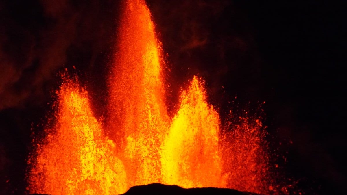
When a fissure eruption begins on the Reykjanes Peninsula, it does not announce itself with a single mountain-top vent. The ground simply tears: a bright seam of fire opening across the lava field, sometimes kilometres long, in a matter of minutes. Since December 2023 that seam has reopened six times in almost the same stretch of Icelandic countryside, close enough to Grindavik and the Blue Lagoon spa to force repeated evacuations. The obvious question, for the roughly 4,000 people who used to live in the town, is brutally practical: where will the next one crack open, and how violent will it be?
A study published on 11 July 2026 in Bulletin of Volcanology offers the most systematic answer yet, and part of the answer is disarmingly ordinary. It is the shape of the land itself (the ridges, scarps and old lava piles left by earlier eruptions) that largely decides where the next fissure will run. Led by Rebekah Rhodes with David Pyle, Tamsin Mather, Gro Pedersen and Michelle Parks, a team spanning the University of Oxford, the University of Iceland and the Icelandic Meteorological Office reconstructed the exact geometry of six eruptions from December 2023 to September 2024 using satellite and aerial imagery, then turned to an unlikely instrument to gauge their fury: the recreational livestream cameras that thousands of people watched from home (full paper; the peer-reviewed version of an earlier preprint).
The ground remembers
Deep magma sets the stage for a Reykjanes eruption. A dike, a blade of molten rock, forces its way up from a shallow reservoir beneath the Svartsengi area and propagates sideways underground until, somewhere along its length, it breaks the surface. Textbook accounts tend to treat that final breakthrough as governed by stress at depth. The new mapping complicates that picture. Where the fissure actually opens, the authors find, is "heavily influenced by topography," including surface features that run parallel to the fissure's strike and, tellingly, features formed during previous eruptions.
In other words, the ground remembers. Each eruption builds low ridges and cones of fresh lava, and those piles then bias where the next batch of magma finds its easiest path to the surface. It is a feedback loop written into the landscape: the more the same corridor erupts, the more its topography channels future eruptions back toward it. That is why the Sundhnukur fissure row, a few kilometres northeast of Grindavik between the Sundhnuksgigar craters and the hill of Stora-Skogfell, keeps reactivating rather than the activity wandering freely across the peninsula.
For hazard planners, that is the useful part. If topography steers the openings, then the areas most vulnerable to a future fissure are not a mystery to be redrawn from scratch each time; they can be read, in part, off the terrain that earlier eruptions have already sculpted. The team frames the work squarely in those terms: understanding the controls on fissure location "highlights areas most vulnerable to future fissure opening," and the eruptions are expected to continue intermittently for decades, perhaps centuries.
Measuring the fountains from a webcam
The second half of the study tackles a different question: not where the fire breaks out, but how hard. Fire fountains, the incandescent jets of molten rock thrown up along an active fissure, are one of the clearest signals of an eruption's intensity. They are also awkward to measure: you cannot walk up to one with a ruler, and dedicated scientific cameras are not always trained on the right segment at the right moment.
So the researchers used what was available. During four of the six eruptions, publicly streamed webcams, the same feeds that drew huge online audiences, captured the fountains against fixed, mappable backgrounds. By calibrating those views, the team extracted fountain heights frame by frame. The maximum heights ranged from 56 metres during the January 2024 eruption to 133 metres during the August 2024 eruption, the tallest in the sequence.
Within a single eruption the fountains varied too, both between different segments of the same fissure and over time. That variation, the study concludes, is controlled mainly by two things: the size of the surface vent and the pressurisation of the feeding dike. Both push up the mass eruption rate (the sheer quantity of magma pumped out per second), and a higher eruption rate drives a taller fountain. A narrow vent fed by a well-pressurised dike throws lava higher than a wide, sluggish one.
An accidental monitoring network
The webcam result carries a methodological sting. Footage shot by hobbyists and tourism livestreams, never intended as a scientific instrument, turned out to be good enough to quantify one of the harder-to-capture aspects of an eruption. The authors argue the lesson should be designed in rather than lucked into: deliberate digital video capture of future eruptions from multiple angles, they write, "would augment monitoring and help refine models of fire-fountain evolution."
The sequence is still going: six eruptions are a snapshot of an episode that may run for generations, and the topographic controls the study identifies are strong tendencies, not a timetable. The work narrows where the ground is likeliest to split and clarifies what sets a fountain's height.
For Grindavik, whose residents have shuttled in and out of their homes for more than two years, the value is more modest but real. The next fissure will open somewhere along ground the land itself has already marked out. The tools to watch it climb may be no more exotic than a well-placed camera.
Sources
- Bulletin of VolcanologyPeer-reviewed
- Research SquarePreprint