The Rhythm USGS Used to Time Kīlauea's Lava Fountains Is Missing From the Data

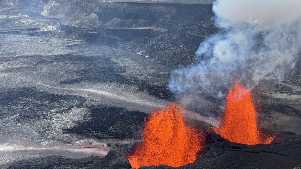
For most of two years, Kīlauea kept appointments. Pressure gathered in the shallow magma reservoir beneath Halemaʻumaʻu, the ground around the crater tilted, and within days or weeks lava rose from the vents in a fountain tall enough to see from the park overlooks. It happened 54 times after the eruption began in December 2024. Then it stopped, with the last of those episodes ending on Aug. 25, 2026, and the fountains have not come back.
On Oct. 7, 2026, the U.S. Geological Survey's Hawaiian Volcano Observatory published a status report with a sentence that is unusual in an agency bulletin: "It is clear that the patterns of forecastable eruptive behavior at Kīlauea summit are no longer being observed in volcano monitoring data." That is a statement about what the monitoring data show, not a verdict on the volcano: the summit is still watched by a dense network of instruments, and a Volcanic Activity Notice will go out if activity changes significantly. Its narrower claim: "It is not possible to forecast an exact outcome of this activity."
By the observatory's own account, the rhythm had been coming apart for months before that. Summit inflation used to run at a steady rate ahead of each fountain; that build changed to a stepwise one before episode 51, and the last four episodes all inflated in fits, with pauses that could last several days. The clock had already begun to lose time while it was still telling it.
What the radar saw that the seismometers could not
The break became visible on the night of Sept. 30, 2026. A swarm of earthquakes began beneath the vents in Halemaʻumaʻu, then shifted northeast into Kaluapele, the summit caldera. About 130 earthquakes were recorded in the swarm that ran from that evening through Oct. 2, 2026, the largest of them a magnitude 3.5. The tiltmeter at Uēkahuna registered more than 40 microradians of tilt over about 18 hours, a shift too small to feel. The other summit tiltmeters barely moved.
The report says seismometers and tiltmeters gave the timing and the general location, but not the shape and size of what had moved. That came from radar. Two passes by the Italian Space Agency's COSMO-SkyMed Second Generation satellites, on Sept. 24, 2026 and Oct. 2, 2026, were combined into an interferogram, an image of how far the ground moved between them. What it shows is a narrow, elongated band of deformation running from the established vent area in Halemaʻumaʻu northwest across Kaluapele: the signature of a dike, a vertical sheet of magma, pushed along fractures that opened in the caldera floor during the collapse of 2018.
How close to the surface is where the agency's own documents part company. The status report describes that band as mapping magma intruding within about 300 meters or less of the surface. The caption USGS published the same day for the same interferogram, on its photo and video chronology, puts the dike about 1 kilometer or less beneath the mapped line. Both are upper limits rather than measurements, and they differ by a factor of three.
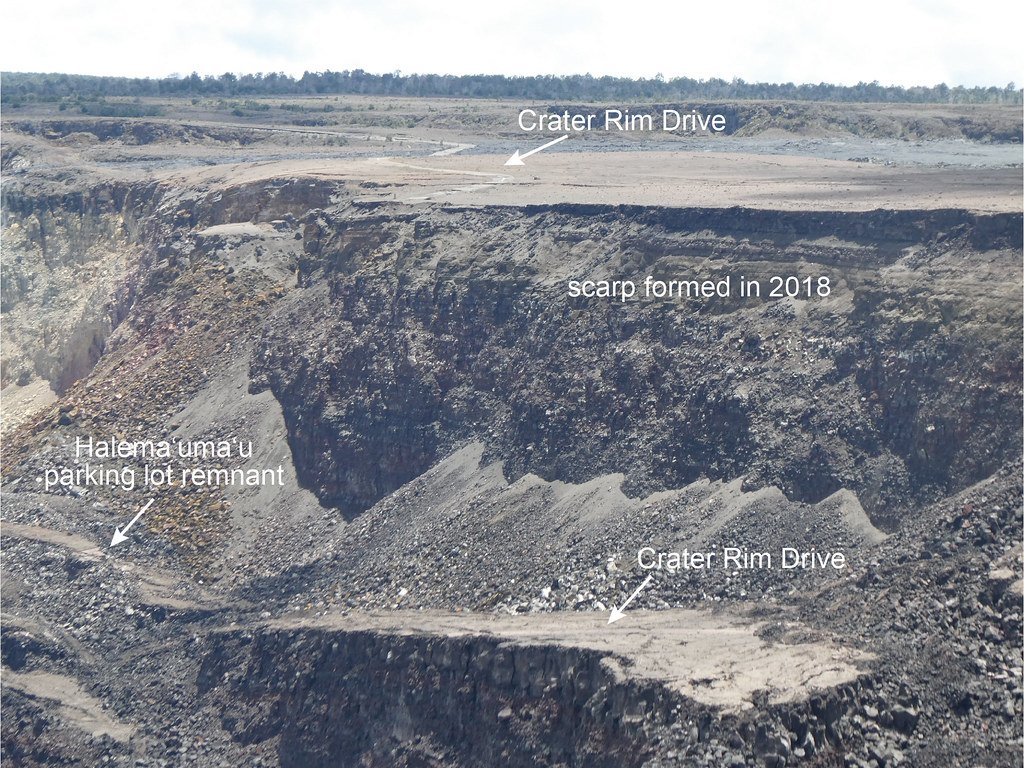
On the ground the intrusion left little: scattered new cracks across the northern floor of Kaluapele, the largest of them 15 centimeters wide when geologists measured it on Oct. 6, 2026. They could tell the cracks were new because they cut through fresh tephra, the ash thrown out by the current eruption, and had pulled delicate suspended roots apart. An overflight on Oct. 1, 2026, described in the observatory's Volcano Watch column of that date, had found no unusually hot ground and no obvious new cracks at all.
Why a taller vent changes the plumbing
The observatory's explanation turns on the height of the vents. Over the course of this eruption the north and south vents have built themselves upward, and the higher they stand, the more pressure it takes to push magma out of them and start a fountain. That same pressure is also high enough to let magma exploit the weaknesses left below the surface by the 2018 crack systems. Six vents that opened on the northwest wall of Halemaʻumaʻu in mid-September 2026, with no swarm and little deformation, pointed the same way: magma no longer has to make space for itself.
Five possible outcomes, and no way to choose
The report lists five scenarios and declines to pick one. The eruption could return to fountaining from the established vents; the conditions for that (vertical conduits, high pressure and continuing magma supply) still exist. Magma could go on intruding within the summit region, which the observatory calls the most likely of the five, most probably in the same fractured ground north of Halemaʻumaʻu. New vents could open inside the summit caldera. Magma could move into the upper Southwest Rift Zone or East Rift Zone. Or the eruption could stop.
For the shape of those outcomes the observatory reaches into Kīlauea's own history and offers two eruptions as precedent rather than prediction. The 1983 Puʻuʻōʻō eruption and the 1969 Maunaulu eruption both continued after their fountaining episodes ended, with fissures opening nearby or vents collapsing. Both changed in the same direction: from short-lived, high-volume episodic fountains to long-lived, low-volume continuous outflow. At Puʻuʻōʻō the switch came in July 1986, when years of high fountains gave way to a quiet flow from a new vent, Kupaianaha.
None of this has moved the official posture. In the report the Volcano Alert Level stayed at WATCH and the Aviation Color Code at ORANGE, both unchanged rather than raised. Activity remains inside the summit caldera, where the observatory expects most impacts to stay; the hazard it names for periods of heavy shaking is rockfall at the cliff edges around the caldera and at the base of the cliffs. Hawaiʻi Volcanoes National Park closed Halemaʻumaʻu Trail and part of Byron Ledge Trail, 1.3 miles of path in all, from 5 p.m. HST on Oct. 7, 2026, citing continued inflation and increased seismicity; viewing areas on the Keanakākoʻi side of the caldera were already shut. No evacuation has been ordered. These are restrictions on where visitors may walk.
What the episode shows is how much eruption forecasting leans on a volcano repeating itself. The instruments above Kaluapele have not changed, and for most of the past two years they gave the observatory enough warning to say a fountain was coming. What the summit stopped supplying is the repetition they had learned to read.