When Earthquakes Jump Between Faults, Italy's Hazard Map Changes

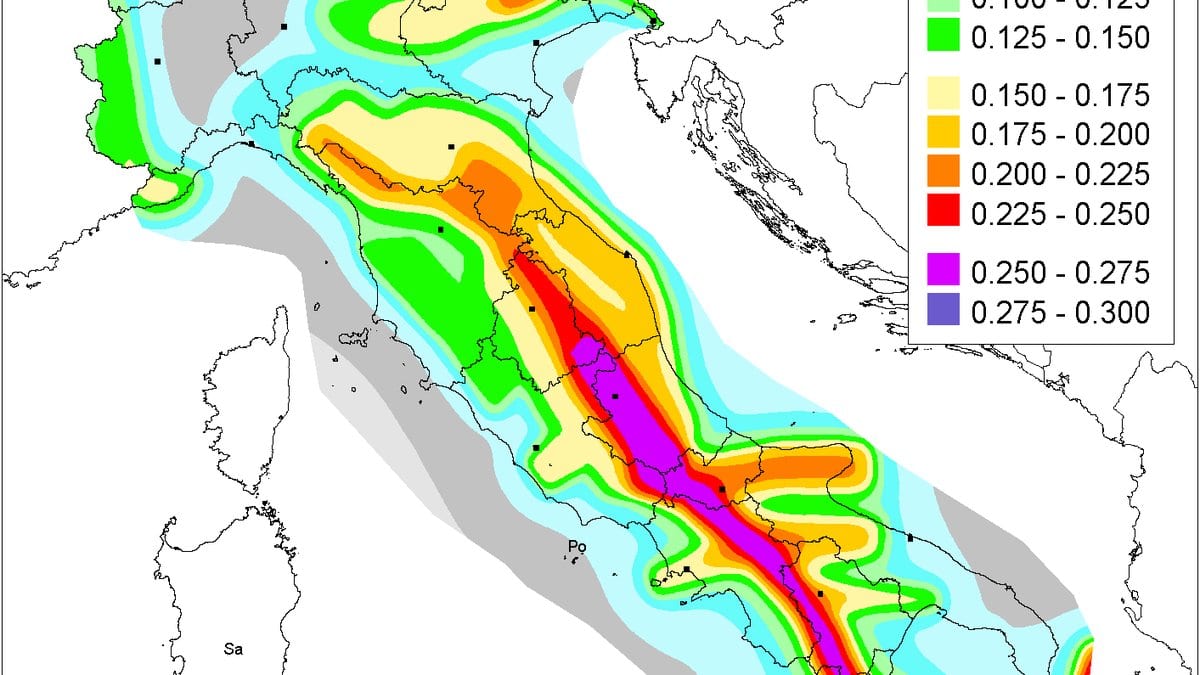
On 23 November 1980, an earthquake struck the Irpinia district of southern Italy and did not stop at one fault. The rupture broke three fault segments in sequence, reaching magnitude 6.9 and killing thousands. It is a textbook case of a hazard that a fault-by-fault accounting can miss: the danger lay not in any single structure but in several of them failing together.
That problem sits at the centre of a study by Giulia Alessandrini of Italy's National Institute of Geophysics and Volcanology (INGV) and colleagues in Spain and Italy, published 23 July 2026 in Natural Hazards and Earth System Sciences. Their subject is how to estimate seismic hazard in a region where the biggest earthquakes are the ones that link faults together, and where the standard method is poorly suited to catching them.
The standard method leans on the historical catalogue: the record of past earthquakes, their sizes and how often they recurred. Italy's official hazard model, which feeds the national building code, is built this way, and for common, moderate earthquakes it works. The trouble is the tail. The largest events are, by definition, rare, so they are thin or absent in even a long written record, and a catalogue that has not happened to log a giant can quietly understate how often one comes. In a region whose defining earthquake broke three faults at once, that is not a small blind spot.
Alessandrini and colleagues take the other route. Instead of starting from the earthquakes, they start from the faults. Fault-based probabilistic seismic hazard assessment builds the earthquake rate up from the geometry and slip of the faults themselves, then asks how often and how hard the ground should shake. Crucially, it can be told to allow ruptures that leap from one fault to the next, producing larger earthquakes than any single fault could generate alone.
To do it, the team used a modelling framework called SHERIFS across 35 fault sections spanning roughly 50,000 square kilometres of the southern Apennines. Because such an exercise is riddled with choices, from how faults are allowed to link to how earthquake size scales with rupture length, they did not run it once. They ran 1,080 configurations, sweeping through those uncertainties rather than betting on one set of assumptions.
Then they checked the models against reality, and the contrast was sharp. Single-fault scenarios, which keep every rupture confined to its own fault, showed no match between the modelled earthquake rates and the observed catalogue across the magnitude range. Multi-fault scenarios, which let ruptures jump, agreed strongly with the catalogue for earthquakes up to about magnitude 6.0. The models were also weighed against paleoseismic data, the geological traces of prehistoric earthquakes preserved on three faults, and the best multi-fault configurations closely matched those long-term rates for two major faults. The historical record reaches back through the CPTI15 catalogue across nearly a thousand years, from 1019 to 2017; the paleoseismic record reaches further still.
The configurations that fit best allowed sizable but not extreme linkage, ruptures reaching up to about 75 kilometres and magnitudes around 7.4, rather than the most sprawling multi-fault chains the framework could build. The point is not that faults join at every opportunity. It is that letting them join sometimes, in geologically plausible ways, reproduces the real earthquake record that a single-fault view cannot.
The stakes are concrete. The study area takes in the Irpinia district, home to active but poorly characterized faults and to several large earth dams, infrastructure for which underestimating the rare, largest earthquake is precisely the failure mode that matters most. Italy's official code currently excludes multi-fault rupture. This study is one region's case, built on a specific set of faults and choices, that leaving it out understates the hazard where the historical catalogue is thinnest, and that the faults themselves have a more complete story to tell than the written record alone.
Sources
- Natural Hazards and Earth System SciencesPeer-reviewed