Six Narwhals Carried Sensors Into Fjords No Ship Can Reach

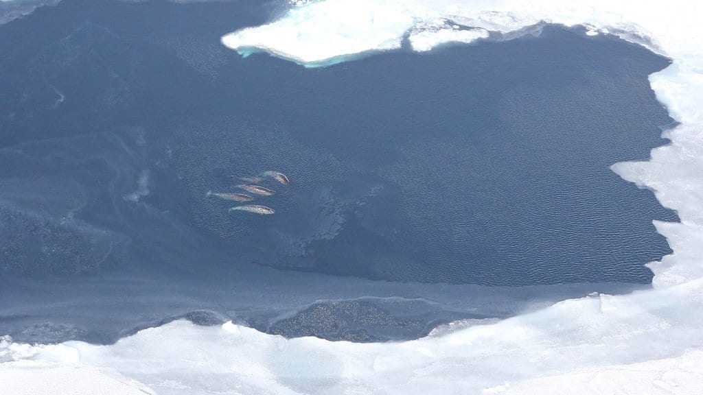
One autumn, a narwhal swimming up Nordvestfjord, a long, ice-covered arm of water in East Greenland, dove down through the cold surface layer into the warmer, saltier water beneath it. Behind the animal's dorsal ridge was a small instrument logging temperature, salinity and depth on the way back up. The whale was probably hunting. It was also doing oceanography, in a fjord where almost nobody has ever taken a measurement.
It was one of six narwhals tagged near Scoresby Sound, on Greenland's east coast, by local hunters working with Mads Peter Heide-Jørgensen of the Greenland Institute of Natural Resources. Between Aug. 2017 and July 2020, the six of them returned 2,060 profiles of the water column, some from more than a kilometer down, along a coast that pack ice kept ships out of for centuries. Their measurements, published Aug. 26, 2026, in Science Advances, were set beside an archive of ship soundings reaching back more than a century.
The tags were never recovered, so they could not be recalibrated afterward. The team checked them against database profiles taken nearby instead, and flagged salinity, rather than temperature, as the reading most likely to have drifted over a long deployment.
East Greenland's coastal water comes in two layers. Cold, fresh Polar Water flows south at the surface, out of the Arctic; below it lies Atlantic Intermediate Water, warmer and saltier, carried west across the Fram Strait and then south along the shelf. In the Blosseville Basin, off the coast south of Scoresby Sound, the Atlantic layer takes over below about 250 meters, with almost no polar water left at those depths.
The cold layer runs out first
What the narwhals added is the inland picture. At the mouth of Scoresby Sound, about 300 kilometers from the glaciers at the head of the system, the cold polar layer covers the surface; travel west toward the ice and it thins, and well before the glaciers it is gone altogether. The Atlantic layer underneath keeps going. It passes over the sill at the fjord's mouth and fills a trench in front of the ice more than a kilometer deep.
"The narwhals have been in parts of the fjords where very few measurements have been taken before. And there, 300 kilometers from the coast, we find traces of Atlantic water. It is completely new that we can show this," Heide-Jørgensen said in a statement from the University of Copenhagen.
Depth decides which glaciers get the heat
Whether a glacier meets that water is largely a question of shape. The Atlantic layer only touches the ice if the basin in front of it is deep enough and the glacier's base reaches down into that layer. Along the Blosseville Coast, south of Scoresby Sound, glacier fronts stand in about 450 meters of water on average. Inside Scoresby Sound they average nearer 800, and in Kangerlussuaq deeper still. The glaciers ending in those deep basins sit in significantly warmer water than the shallow-basin ones, which are much closer to the open sea the warm water comes from.
A sill, the shallow ridge across a fjord mouth, is the usual explanation for a glacier that stays cold. It is not the explanation here. In every fjord these whales surveyed, the sill was deep enough to let the warm layer over: Nordvestfjord's sits at about 400 meters, and in Gåsefjord the shallowest point the narwhals found anywhere along the fjord was deeper than that. What holds the Atlantic water back on the Blosseville Coast is the lack of a deep basin in front of the glaciers, not a barrier at the entrance. Shallower sills probably do exist elsewhere, the authors write, in fjords nobody has surveyed; most of the fjords here have never been properly depth-charted, and a diving narwhal only ever tells you the water is at least that deep.
What the warm water does to the ice
The reason a few hundred meters of seafloor matters is what it does to the ice. Across the fjords in the study, the share of a glacier's summer mass loss that leaves as icebergs rather than meltwater rises with the water temperature in front of it: where that water is at freezing or below, icebergs account for less than a tenth of the loss, and the proportion climbs from there. This is an association measured across glaciers, not an experiment. The authors put their conclusion carefully: the warm water is "likely promoting" the melting and the calving, and their profiles confirm what ocean models had assumed about heat reaching these fronts, in a place where the models had no measurements to work from.
Set against the ship archive, the narwhal profiles also give a longer view. Along this coast both water masses have warmed by roughly 0.10 °C to 0.25 °C per decade in summer since 1970. The figure rests on thin data: before 2010 only a handful of profiles exist from the fjord system, some of the oldest are of uncertain quality, and the authors say the absence of measurements from Scoresby Sound prevents a robust assessment of long-term trends. The winter numbers are weaker again, because almost all the recent winter profiles are the narwhals' own, and a cold-water animal may not visit the warm Atlantic layer as often as the polar water above it.
"Now we suddenly have measurements from places we can use in our models, giving us a much more complete picture of the ocean," said Susanne Ditlevsen, a statistician at the University of Copenhagen and one of the study's authors. That is the practical yield here: an ice-choked coastline that produced almost no data for a century now produces two profiles a day, for as long as a tag stays on a whale. The study is open access. The authors expect the same warm water that is thinning the ice to push boreal species into fjords that have been too cold for them.
Sources
- Science AdvancesPeer-reviewed
- science.ku.dk