Europe Has More Trees. A New Study Asks Whether They Join Up.

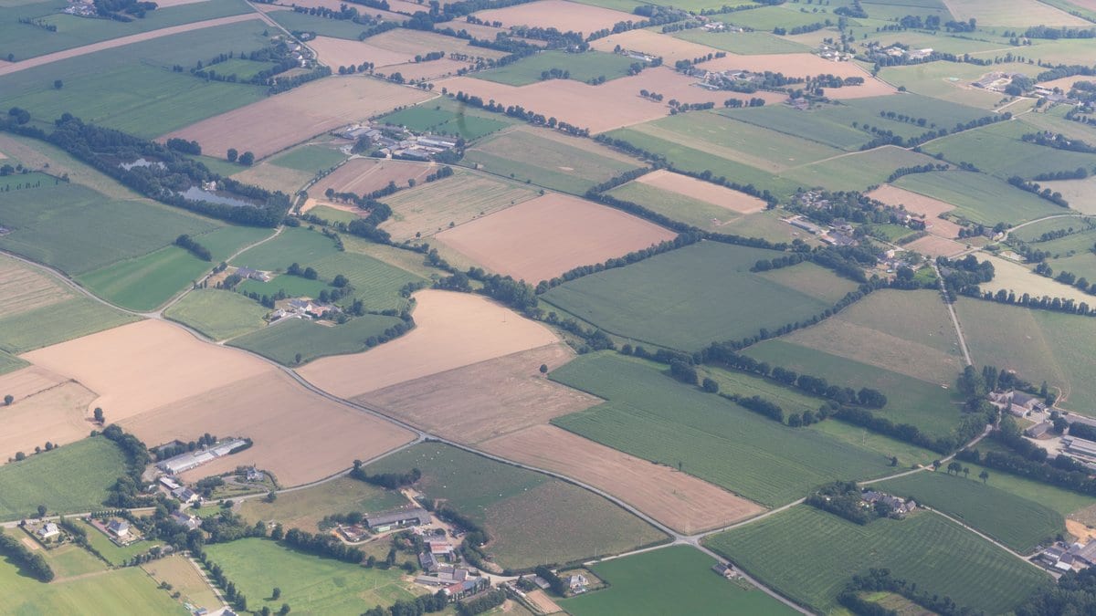
Leave a field in central Europe unplowed and it does not stay a field. Brambles and scrub come first, then birch or pine seedlings among them, and within two decades there can be a closed canopy where the furrows used to run. Multiply that by a continent, and by years of farmers walking away from land that no longer paid, and you have the thing satellite surveys have been reporting for most of this century: Europe has more trees than it used to.
Counting those trees is the part satellite mapping does well. Wanben Wu and Jens-Christian Svenning at Aarhus University, with colleagues at Humboldt University Berlin, argue that counting them has stopped being enough. In a paper published Oct. 31, 2026, in Communications Earth & Environment, they measured three properties of Europe's tree cover from 2001 to 2021 instead of one: how much canopy there is, how well it joins up, and how varied it is from place to place. As they put it, long-term, continent-wide assessments "have largely focused on tree cover alone."
Two landscapes can hold the same number of trees
The two added properties have plain meanings. Connectivity here is whether the trees join up: whether patches sit close enough together to work as one piece of habitat for an animal or a seed that has to cross the gap between them. Heterogeneity is variety in structure: whether a neighborhood holds dense stands, thin ones and open gaps, or much the same cover everywhere.
An extent map cannot see either, because it answers one question per cell, which is how much. Two cells can carry the same share of canopy while one is a single block of even-aged plantation and the other a mosaic of copses, hedges and clearings. For a woodpecker the first is the better place; for a lark, a butterfly or a plant that needs open ground, the second is. A percentage cannot tell them apart, and the paper's opening line keeps the caution the rest of it earns: the amount and arrangement of trees "can strongly influence ecosystem functioning and biodiversity."
The pattern that covered the most ground
Measured together across the continent, the three trends sort landscapes into combinations, and one combination came up more often than any other. It covers 23% of the area the team analyzed, and in it tree cover rose, connectivity rose and structural variety fell. More trees, better joined up, more alike.
The second finding is a correlation rather than a place. In grid cells of 0.25 degrees, each covering a landscape rather than a wood, the cells with larger fractions of former cropland "tended to exhibit more positive trends in tree cover and connectivity and more negative trends in heterogeneity." The hedge belongs to the authors and it is doing work: this is an association across cells, not a traced chain from an abandoned field to a closed canopy. The paper's own title is bolder, reporting gains that "were strongest in regions of agricultural retreat," while its verb for farmland and the other drivers it tests, climate and natural disturbance among them, is that the trends "are associated with" them.
There is no shortage of former cropland to work with. A 2015 satellite survey of Europe's farmland led by Stephan Estel, published in Remote Sensing of Environment, mapped up to 7.6 million hectares abandoned between 2001 and 2012, mainly in Eastern Europe, Southern Scandinavia and Europe's mountain regions. Two of its authors, Tobias Kuemmerle and Alexander Prishchepov, are on the new paper. Trees arrive on that ground without anyone planting them.
The authors' own conclusion is that tree-cover gains "do not necessarily coincide with increasing tree-cover heterogeneity." They read the combination as a potential benefit for carbon accumulation and for species that live in forest, and a possible cost for species that depend on open or structurally varied habitat. Neither the carbon nor any species was measured in this study; that reading is theirs, drawn from the trend maps, and the hedges in it are theirs too. What they are working from is the accepted version of their paper, published ahead of the journal's final edit with a transparent peer review file attached.
Connectivity is now something the EU counts
Europe has written both of the new measurements into policy. The European Environment Agency states it plainly: "Forest connectivity is a headline indicator for monitoring progress towards the 8th Environment Action Programme," the EU's current environment action program. The agency lists what else rests on expanding tree and forest cover: the Nature Restoration Regulation, the EU's forest and biodiversity strategies for 2030, and a pledge to plant 3 billion more trees by then.
That same agency measures connectivity itself, and its number moves the other way. It puts the EU's average forest connectivity at 80.6% in 2021, down 0.8 percentage points from 2018, and its own assessment is that "it is unlikely that forest connectivity will increase by 2030." The two results are not in conflict, and neither supports the other. The agency compares two snapshots, counts forest only, and uses a density measure built on Copernicus satellite layers in which clearcut, burnt and windthrown stands count as fragmenting, which is how bark beetles and storms pull the figure down. Its definition of forest also excludes agricultural land, so trees creeping into an abandoned field can take years to register as forest at all, while the new paper counts them as tree cover from the start.
What three measurements hand a restoration program is a way to be judged on something other than hectares. A planting scheme can be asked whether what it adds joins existing patches up, and whether it adds structural variety or removes it. The new paper does not say which of the three should win when they pull apart, and on its own evidence it could not. It says that across Europe, over those two decades, they did pull apart.
Sources
- Communications Earth & EnvironmentPeer-reviewed
- www.eea.europa.eu