The Glaciers Left in the American West Are Mostly the Ones the Sun Misses

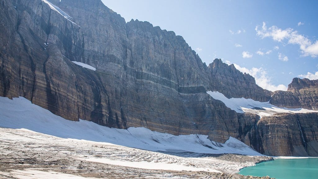
From an airplane over the Rocky Mountain West, a glacier does not look much like a glacier. It looks like a small patch of white tucked into a fold in the landscape, with a band of gray-blue bare ice showing below the snow. Andrew Fountain, a geographer at Portland State University, photographed exactly that in October 2026 while flying over the Wind River Range in Wyoming, and most of the patches he saw were sitting in some kind of protective niche.
Fountain is the first author of the first comprehensive measure of how much area and volume the glaciers of the western United States have lost. It was published online Oct. 12, 2026, in the Proceedings of the National Academy of Sciences. His co-authors are Bryce Glenn, also at Portland State, Christopher McNeil of the US Geological Survey and Brian Menounos of the University of Northern British Columbia. The paper reports that about one-quarter of the glaciers of the western conterminous United States have disappeared since the mid-20th century, and that the overall area and volume are reduced by one-third.
The glaciers themselves had been counted before, by much the same group, in a 2023 inventory of the glaciers and perennial snowfields of the conterminous United States. The new paper's claim to a first is narrower than a head count, and more useful: how much of that ice has gone.
The result the paper leads with, though, is not the loss but what its shape implies about the ice that is left. The authors report that the pattern of shrinkage suggests that most glaciers in the conterminous United States are largely maintained by local topographic influences, because they are now so small. The survivors may be surviving on shade and drifted snow rather than on the climate of the range they sit in. The word in the paper is suggests: this is read off the map of what survives rather than from an experiment that isolated a cause.
Shade and snow delivered by avalanche
Fountain filled in the mechanism himself in an essay for The Conversation published the same day. He treats two sets of ranges as one class, set against Washington's much larger and snowier ice: the Rockies of Colorado, Montana and Wyoming, and the Sierra Nevada of California. He writes that the glaciers surviving in those ranges sit in shaded niches that take less direct sun, and are topped up by snow that avalanches down onto them. Exposed to more sun and given less snow, they probably would not be there at all. He says the finding surprised him: these glaciers subsist on a particular position in the landscape, which partly insulates them from a regional climate that is otherwise against them.
The supporting observation is a contrast between two regions. In Washington, loss generally falls as you climb: the higher the glacier, the less of it has gone, which is what you would expect if summer warmth were in charge. In the Rocky Mountain region, there is no such trend, and that absence is what points to niche glaciers held up by local advantage.
How small the ice has become
Smallness is the condition that makes terrain decisive, and these glaciers are small. The average one covers about one-tenth of a square mile. The largest by area sits on Mount Rainier in Washington and covers about 4.3 square miles (11.24 square kilometers), and Fountain puts Rainier's glacier cover alone above the total of every other state combined.
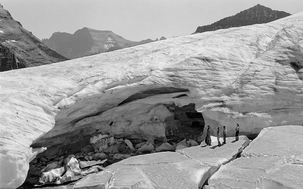
The thinning is fastest where the ice is most exposed. The quickest losses are in the Beartooth-Absaroka Mountains of southern Montana, about 1.5 feet of ice thickness a year, or half a meter. On Mount Rainier and Mount Baker, which have cooler summers and a great deal more snowfall, it is about half a foot a year. Those two, Fountain expects, will likely last past 2100, though he adds that how much longer is an open question.
Fountain's own count of the outright losses is the number that carries his essay: a little more than 300 glaciers have disappeared, more than he says he had anticipated.
Fountain has modeled one of these ranges before. In a 2022 study, he and colleagues projected that most of the glaciers on Washington's Olympic Peninsula would disappear by 2070 under current climate trends. That is a separate, earlier paper rather than a result of the new assessment, and the Olympics are a particular case: close to the Pacific and at relatively low elevation. He reads it as a sign that glaciers elsewhere are probably not far behind.
What leaves with the ice
What the loss costs is mostly downstream. In the essay, Fountain puts the glaciers' principal importance as water for high alpine ecosystems: they melt back in late summer and deliver cool water to cold-adapted fish and other stream life at the one point in the year when the seasonal snow is gone and the rain has not come. Washington's glaciers also feed hydropower.
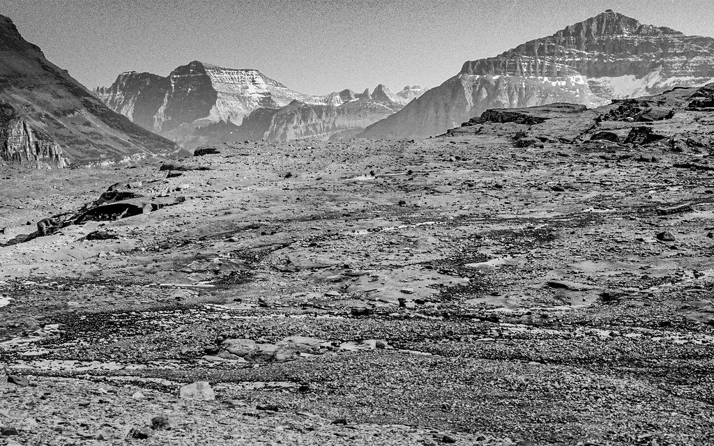
And the retreat leaves a hazard behind it on the steep-sided volcanoes of the Cascade Range, where glaciers have built unusually large moraines (ridges of rock piled up at their lower ends by the moving ice) out of the easily eroded volcanic rock beneath. As the ice pulls back, those ridges stand without the ice that buttressed them, and high water from rain or melt can undercut them and send debris flows down the mountain. That happened in 2006 on Mount Hood and Mount Rainier and closed a number of highways. Fountain expects it more often as the glaciers retreat, which is his reading of the mechanism rather than a measurement in the new paper.
The ice that is left is not left because the West turned out cold enough for it. On the paper's reading, it is left because of where it happens to sit, which is a narrower kind of shelter than a climate.